V54A Nebo, NC, USA - Earthquake Result Viewer
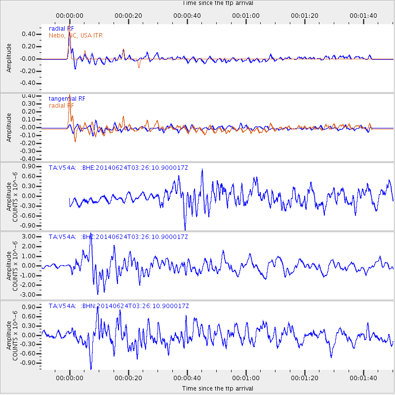
Earthquake location: Rat Islands, Aleutian Islands
Earthquake latitude/longitude: 52.3/176.7
Earthquake time(UTC): 2014/06/24 (175) 03:15:36 GMT
Earthquake Depth: 4.0 km
Earthquake Magnitude: 6.3 MWB, 5.7 ML, 6.4 MWC, 6.6 MI
Earthquake Catalog/Contributor: NEIC PDE/NEIC COMCAT
Network: TA USArray Transportable Network (new EarthScope stations)
Station: V54A Nebo, NC, USA
Lat/Lon: 35.78 N/81.95 W
Elevation: 448 m
Distance: 68.9 deg
Az: 58.746 deg
Baz: 319.737 deg
Ray Param: 0.05604634
Estimated Moho Depth: 41.0 km
Estimated Crust Vp/Vs: 1.79
Assumed Crust Vp: 6.419 km/s
Estimated Crust Vs: 3.591 km/s
Estimated Crust Poisson's Ratio: 0.27
Radial Match: 87.79799 %
Radial Bump: 400
Transverse Match: 67.48364 %
Transverse Bump: 400
SOD ConfigId: 739768
Insert Time: 2014-07-08 04:22:49.765 +0000
GWidth: 2.5
Max Bumps: 400
Tol: 0.001

Signal To Noise

ChannelStoNSTALTA
TA:V54A: :BHZ:20140624T03:26:10.900017Z3.72042636.4734036E-71.739963E-7
TA:V54A: :BHN:20140624T03:26:10.900017Z1.87271481.5798774E-78.436295E-8
TA:V54A: :BHE:20140624T03:26:10.900017Z1.67804831.6770065E-79.9937914E-8
Arrivals
Ps5.2 SECOND
PpPs17 SECOND
PsPs/PpSs22 SECOND