You are here: Home > Network List > II - Global Seismograph Network (GSN - IRIS/IDA) Stations List
> Station WRAB Tennant Creek, NT, Australia > Earthquake Result Viewer
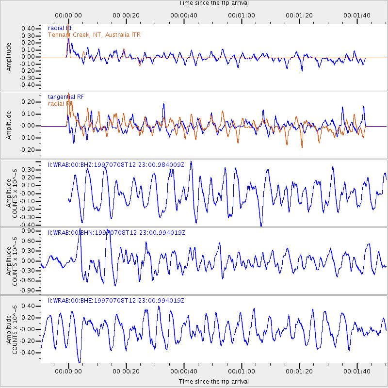
WRAB Tennant Creek, NT, Australia - Earthquake Result Viewer
*The percent match for this event was below the threshold and hence no stack was calculated.
| Earthquake location: |
Andreanof Islands, Aleutian Is. |
| Earthquake latitude/longitude: |
51.4/-178.6 |
| Earthquake time(UTC): |
1997/07/08 (189) 12:11:15 GMT |
| Earthquake Depth: |
33 km |
| Earthquake Magnitude: |
5.5 MB, 5.4 MS, 5.8 UNKNOWN, 5.6 ML |
| Earthquake Catalog/Contributor: |
WHDF/NEIC |
|
| Network: |
II Global Seismograph Network (GSN - IRIS/IDA) |
| Station: |
WRAB Tennant Creek, NT, Australia |
| Lat/Lon: |
19.93 S/134.36 E |
| Elevation: |
366 m |
|
| Distance: |
82.1 deg |
| Az: |
224.055 deg |
| Baz: |
27.598 deg |
| Ray Param: |
$rayparam |
*The percent match for this event was below the threshold and hence was not used in the summary stack. |
|
| Radial Match: |
60.065247 % |
| Radial Bump: |
397 |
| Transverse Match: |
51.482872 % |
| Transverse Bump: |
400 |
| SOD ConfigId: |
4480 |
| Insert Time: |
2010-03-01 23:32:16.909 +0000 |
| GWidth: |
2.5 |
| Max Bumps: |
400 |
| Tol: |
0.001 |
|
Signal To Noise
| Channel | StoN | STA | LTA |
| II:WRAB:00:BHN:19970708T12:23:00.994019Z | 2.5107803 | 3.7778315E-7 | 1.5046444E-7 |
| II:WRAB:00:BHE:19970708T12:23:00.994019Z | 2.2262075 | 3.042363E-7 | 1.3666124E-7 |
| II:WRAB:00:BHZ:19970708T12:23:00.984009Z | 1.2174519 | 2.1013703E-7 | 1.7260396E-7 |
| Arrivals |
| Ps | |
| PpPs | |
| PsPs/PpSs | |


