V56A Mocksville, NC, USA - Earthquake Result Viewer
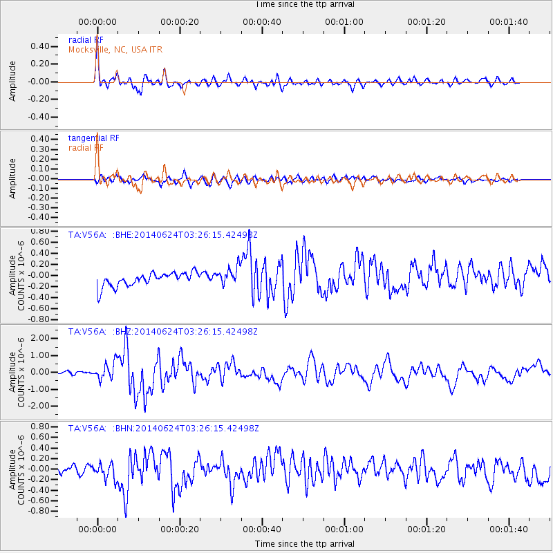
Earthquake location: Rat Islands, Aleutian Islands
Earthquake latitude/longitude: 52.3/176.7
Earthquake time(UTC): 2014/06/24 (175) 03:15:36 GMT
Earthquake Depth: 4.0 km
Earthquake Magnitude: 6.3 MWB, 5.7 ML, 6.4 MWC, 6.6 MI
Earthquake Catalog/Contributor: NEIC PDE/NEIC COMCAT
Network: TA USArray Transportable Network (new EarthScope stations)
Station: V56A Mocksville, NC, USA
Lat/Lon: 35.81 N/80.50 W
Elevation: 237 m
Distance: 69.6 deg
Az: 57.757 deg
Baz: 320.231 deg
Ray Param: 0.055562902
Estimated Moho Depth: 41.5 km
Estimated Crust Vp/Vs: 1.63
Assumed Crust Vp: 6.419 km/s
Estimated Crust Vs: 3.938 km/s
Estimated Crust Poisson's Ratio: 0.20
Radial Match: 86.55616 %
Radial Bump: 400
Transverse Match: 69.15817 %
Transverse Bump: 400
SOD ConfigId: 739768
Insert Time: 2014-07-08 04:22:58.662 +0000
GWidth: 2.5
Max Bumps: 400
Tol: 0.001

Signal To Noise

ChannelStoNSTALTA
TA:V56A: :BHZ:20140624T03:26:15.42498Z3.99013525.493426E-71.3767519E-7
TA:V56A: :BHN:20140624T03:26:15.42498Z2.3666991.5578497E-76.582374E-8
TA:V56A: :BHE:20140624T03:26:15.42498Z1.3713721.6820329E-71.2265329E-7
Arrivals
Ps4.2 SECOND
PpPs16 SECOND
PsPs/PpSs21 SECOND