W39A Magazine, AR, USA - Earthquake Result Viewer
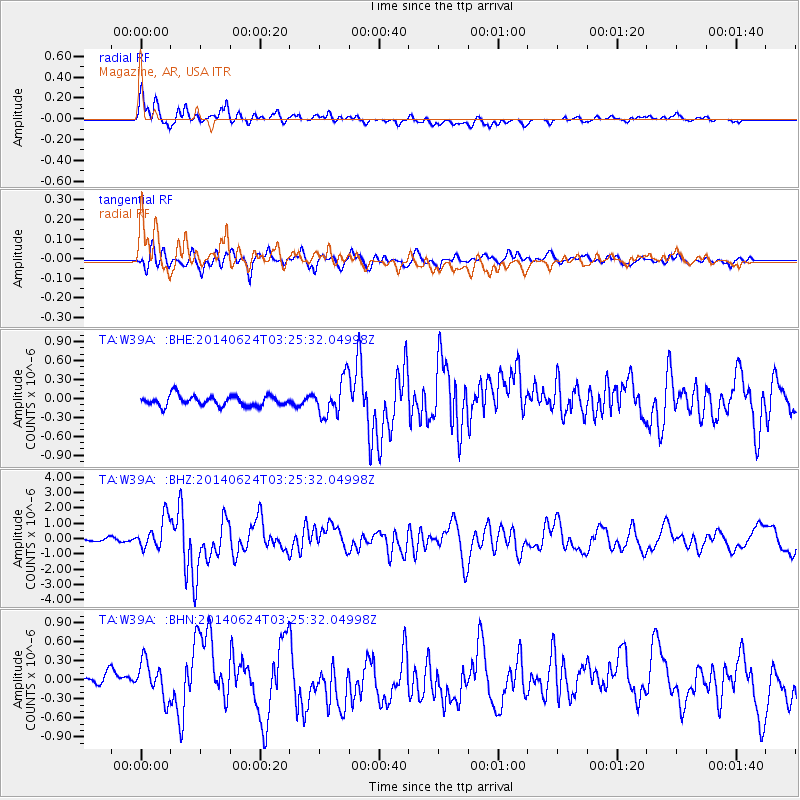
Earthquake location: Rat Islands, Aleutian Islands
Earthquake latitude/longitude: 52.3/176.7
Earthquake time(UTC): 2014/06/24 (175) 03:15:36 GMT
Earthquake Depth: 4.0 km
Earthquake Magnitude: 6.3 MWB, 5.7 ML, 6.4 MWC, 6.6 MI
Earthquake Catalog/Contributor: NEIC PDE/NEIC COMCAT
Network: TA USArray Transportable Network (new EarthScope stations)
Station: W39A Magazine, AR, USA
Lat/Lon: 35.20 N/93.78 W
Elevation: 162 m
Distance: 62.8 deg
Az: 67.031 deg
Baz: 316.283 deg
Ray Param: 0.059996918
Estimated Moho Depth: 17.75 km
Estimated Crust Vp/Vs: 1.93
Assumed Crust Vp: 6.498 km/s
Estimated Crust Vs: 3.358 km/s
Estimated Crust Poisson's Ratio: 0.32
Radial Match: 86.644554 %
Radial Bump: 400
Transverse Match: 82.59243 %
Transverse Bump: 400
SOD ConfigId: 739768
Insert Time: 2014-07-08 04:23:13.546 +0000
GWidth: 2.5
Max Bumps: 400
Tol: 0.001

Signal To Noise

ChannelStoNSTALTA
TA:W39A: :BHZ:20140624T03:25:32.04998Z9.9764451.0111178E-61.0135051E-7
TA:W39A: :BHN:20140624T03:25:32.04998Z2.66819073.0047963E-71.1261551E-7
TA:W39A: :BHE:20140624T03:25:32.04998Z3.50854832.843991E-78.1058914E-8
Arrivals
Ps2.7 SECOND
PpPs7.7 SECOND
PsPs/PpSs10 SECOND