You are here: Home > Network List > II - Global Seismograph Network (GSN - IRIS/IDA) Stations List
> Station WRAB Tennant Creek, NT, Australia > Earthquake Result Viewer
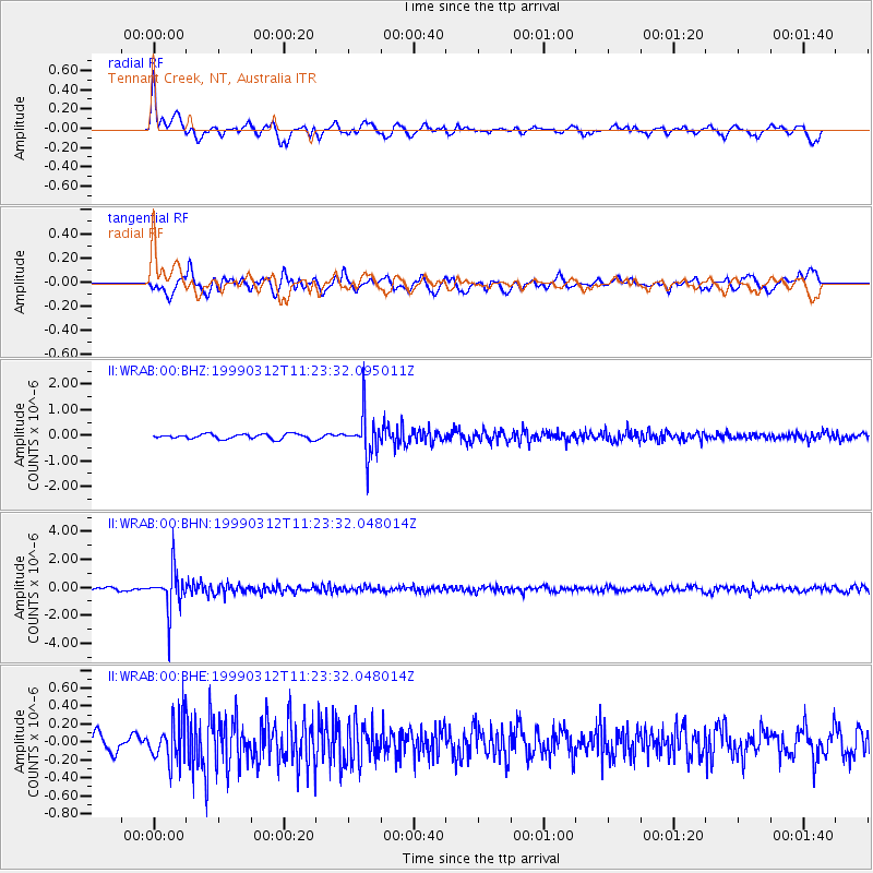
WRAB Tennant Creek, NT, Australia - Earthquake Result Viewer
*The percent match for this event was below the threshold and hence no stack was calculated.
| Earthquake location: |
Fiji Islands Region |
| Earthquake latitude/longitude: |
-20.0/-177.8 |
| Earthquake time(UTC): |
1999/03/12 (071) 11:16:39 GMT |
| Earthquake Depth: |
587 km |
| Earthquake Magnitude: |
5.6 MW, 5.2 MB |
| Earthquake Catalog/Contributor: |
WHDF/NEIC |
|
| Network: |
II Global Seismograph Network (GSN - IRIS/IDA) |
| Station: |
WRAB Tennant Creek, NT, Australia |
| Lat/Lon: |
19.93 S/134.36 E |
| Elevation: |
366 m |
|
| Distance: |
44.9 deg |
| Az: |
261.51 deg |
| Baz: |
98.649 deg |
| Ray Param: |
$rayparam |
*The percent match for this event was below the threshold and hence was not used in the summary stack. |
|
| Radial Match: |
72.33557 % |
| Radial Bump: |
400 |
| Transverse Match: |
59.5589 % |
| Transverse Bump: |
400 |
| SOD ConfigId: |
4480 |
| Insert Time: |
2010-03-01 23:32:21.708 +0000 |
| GWidth: |
2.5 |
| Max Bumps: |
400 |
| Tol: |
0.001 |
|
Signal To Noise
| Channel | StoN | STA | LTA |
| II:WRAB:00:BHN:19990312T11:23:32.048014Z | 10.805556 | 1.479063E-6 | 1.3687986E-7 |
| II:WRAB:00:BHE:19990312T11:23:32.048014Z | 2.2096257 | 2.4027906E-7 | 1.0874198E-7 |
| II:WRAB:00:BHZ:19990312T11:23:32.095011Z | 8.315964 | 7.9520385E-7 | 9.562377E-8 |
| Arrivals |
| Ps | |
| PpPs | |
| PsPs/PpSs | |


