You are here: Home > Network List > II - Global Seismograph Network (GSN - IRIS/IDA) Stations List
> Station WRAB Tennant Creek, NT, Australia > Earthquake Result Viewer
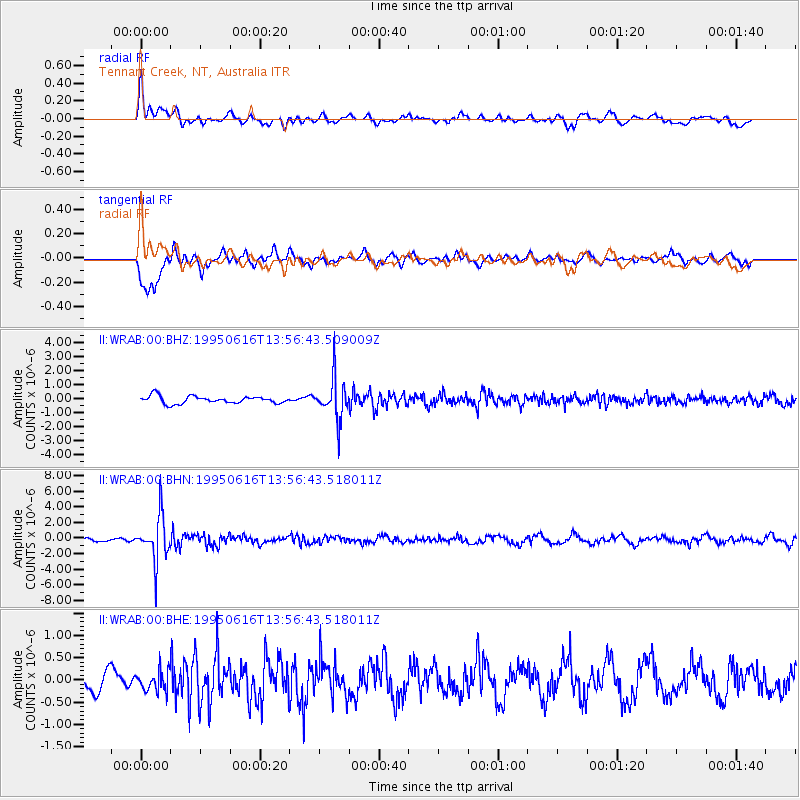
WRAB Tennant Creek, NT, Australia - Earthquake Result Viewer
*The percent match for this event was below the threshold and hence no stack was calculated.
| Earthquake location: |
Fiji Islands Region |
| Earthquake latitude/longitude: |
-18.2/-178.0 |
| Earthquake time(UTC): |
1995/06/16 (167) 13:49:49 GMT |
| Earthquake Depth: |
567 km |
| Earthquake Magnitude: |
5.5 MB |
| Earthquake Catalog/Contributor: |
WHDF/NEIC |
|
| Network: |
II Global Seismograph Network (GSN - IRIS/IDA) |
| Station: |
WRAB Tennant Creek, NT, Australia |
| Lat/Lon: |
19.93 S/134.36 E |
| Elevation: |
366 m |
|
| Distance: |
44.9 deg |
| Az: |
259.825 deg |
| Baz: |
96.147 deg |
| Ray Param: |
$rayparam |
*The percent match for this event was below the threshold and hence was not used in the summary stack. |
|
| Radial Match: |
68.37767 % |
| Radial Bump: |
400 |
| Transverse Match: |
79.838196 % |
| Transverse Bump: |
400 |
| SOD ConfigId: |
4480 |
| Insert Time: |
2010-03-01 23:32:26.189 +0000 |
| GWidth: |
2.5 |
| Max Bumps: |
400 |
| Tol: |
0.001 |
|
Signal To Noise
| Channel | StoN | STA | LTA |
| II:WRAB:00:BHN:19950616T13:56:43.518011Z | 10.16615 | 2.8307306E-6 | 2.7844666E-7 |
| II:WRAB:00:BHE:19950616T13:56:43.518011Z | 0.7648579 | 2.2094231E-7 | 2.8886714E-7 |
| II:WRAB:00:BHZ:19950616T13:56:43.509009Z | 5.5208507 | 1.4463852E-6 | 2.6198595E-7 |
| Arrivals |
| Ps | |
| PpPs | |
| PsPs/PpSs | |


