YACT Amboy, WA, USA - Earthquake Result Viewer
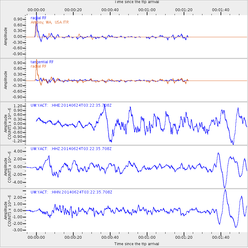
Earthquake location: Rat Islands, Aleutian Islands
Earthquake latitude/longitude: 52.3/176.7
Earthquake time(UTC): 2014/06/24 (175) 03:15:36 GMT
Earthquake Depth: 4.0 km
Earthquake Magnitude: 6.3 MWB, 5.7 ML, 6.4 MWC, 6.6 MI
Earthquake Catalog/Contributor: NEIC PDE/NEIC COMCAT
Network: UW Pacific Northwest Regional Seismic Network
Station: YACT Amboy, WA, USA
Lat/Lon: 45.93 N/122.42 W
Elevation: 211 m
Distance: 39.3 deg
Az: 74.22 deg
Baz: 302.043 deg
Ray Param: 0.075074606
Estimated Moho Depth: 13.75 km
Estimated Crust Vp/Vs: 1.60
Assumed Crust Vp: 6.566 km/s
Estimated Crust Vs: 4.104 km/s
Estimated Crust Poisson's Ratio: 0.18
Radial Match: 87.07063 %
Radial Bump: 300
Transverse Match: 75.10475 %
Transverse Bump: 400
SOD ConfigId: 739768
Insert Time: 2014-07-08 04:32:22.495 +0000
GWidth: 2.5
Max Bumps: 400
Tol: 0.001

Signal To Noise

ChannelStoNSTALTA
UW:YACT: :HHZ:20140624T03:22:35.708Z3.50763735.118817E-71.4593347E-7
UW:YACT: :HHN:20140624T03:22:35.708Z2.10225491.841817E-78.76115E-8
UW:YACT: :HHE:20140624T03:22:35.708Z1.88714642.7390658E-71.4514328E-7
Arrivals
Ps1.4 SECOND
PpPs5.0 SECOND
PsPs/PpSs6.4 SECOND