You are here: Home > Network List > II - Global Seismograph Network (GSN - IRIS/IDA) Stations List
> Station WRAB Tennant Creek, NT, Australia > Earthquake Result Viewer
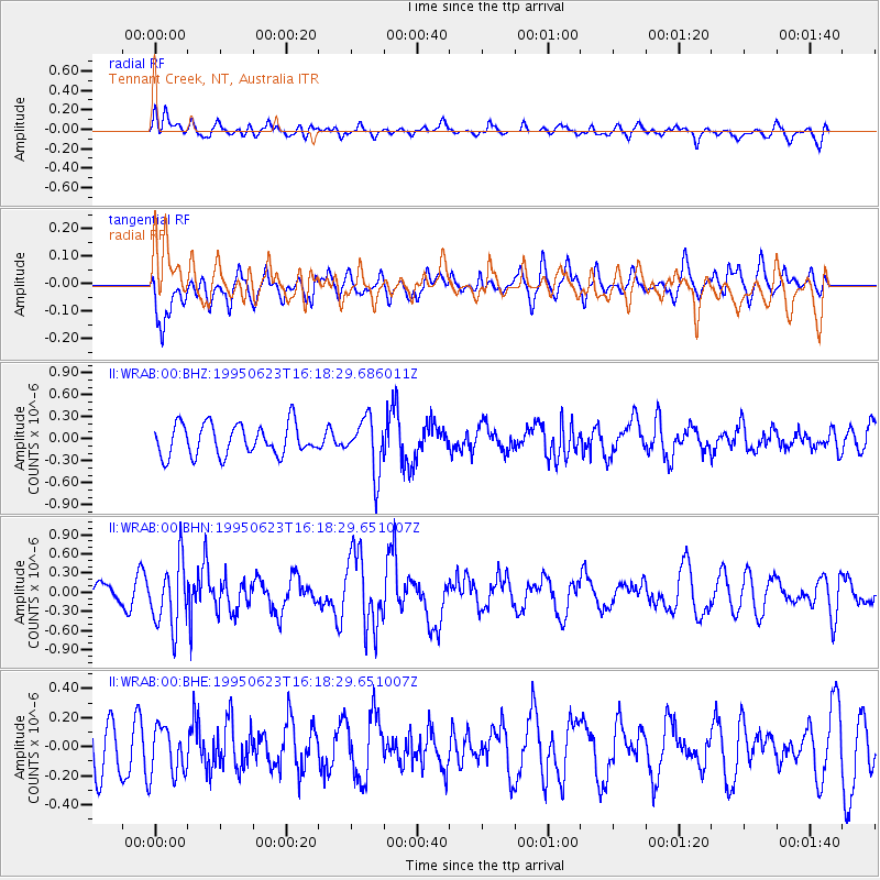
WRAB Tennant Creek, NT, Australia - Earthquake Result Viewer
*The percent match for this event was below the threshold and hence no stack was calculated.
| Earthquake location: |
South Of Fiji Islands |
| Earthquake latitude/longitude: |
-24.6/-177.3 |
| Earthquake time(UTC): |
1995/06/23 (174) 16:10:56 GMT |
| Earthquake Depth: |
108 km |
| Earthquake Magnitude: |
5.8 UNKNOWN, 5.4 MB |
| Earthquake Catalog/Contributor: |
WHDF/NEIC |
|
| Network: |
II Global Seismograph Network (GSN - IRIS/IDA) |
| Station: |
WRAB Tennant Creek, NT, Australia |
| Lat/Lon: |
19.93 S/134.36 E |
| Elevation: |
366 m |
|
| Distance: |
44.8 deg |
| Az: |
265.931 deg |
| Baz: |
105.139 deg |
| Ray Param: |
$rayparam |
*The percent match for this event was below the threshold and hence was not used in the summary stack. |
|
| Radial Match: |
57.351196 % |
| Radial Bump: |
400 |
| Transverse Match: |
56.821915 % |
| Transverse Bump: |
400 |
| SOD ConfigId: |
4480 |
| Insert Time: |
2010-03-01 23:32:28.986 +0000 |
| GWidth: |
2.5 |
| Max Bumps: |
400 |
| Tol: |
0.001 |
|
Signal To Noise
| Channel | StoN | STA | LTA |
| II:WRAB:00:BHN:19950623T16:18:29.651007Z | 2.7357244 | 5.08757E-7 | 1.8596793E-7 |
| II:WRAB:00:BHE:19950623T16:18:29.651007Z | 1.160204 | 1.6601174E-7 | 1.430884E-7 |
| II:WRAB:00:BHZ:19950623T16:18:29.686011Z | 1.7224393 | 3.653426E-7 | 2.1210768E-7 |
| Arrivals |
| Ps | |
| PpPs | |
| PsPs/PpSs | |


