You are here: Home > Network List > II - Global Seismograph Network (GSN - IRIS/IDA) Stations List
> Station WRAB Tennant Creek, NT, Australia > Earthquake Result Viewer
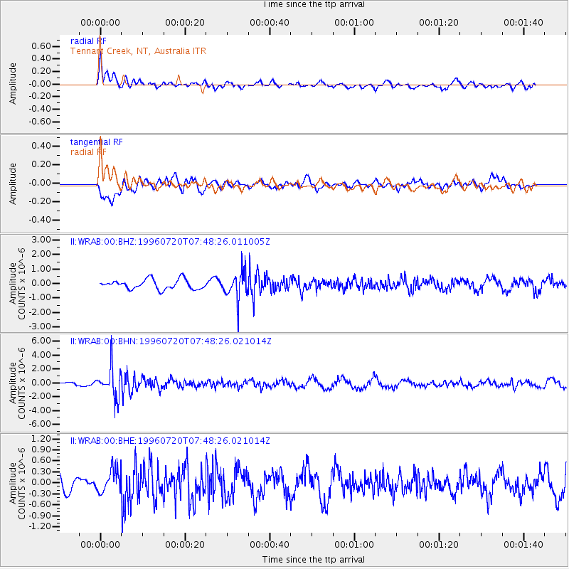
WRAB Tennant Creek, NT, Australia - Earthquake Result Viewer
*The percent match for this event was below the threshold and hence no stack was calculated.
| Earthquake location: |
Fiji Islands Region |
| Earthquake latitude/longitude: |
-19.8/-177.6 |
| Earthquake time(UTC): |
1996/07/20 (202) 07:41:15 GMT |
| Earthquake Depth: |
357 km |
| Earthquake Magnitude: |
5.7 MB, 5.9 UNKNOWN, 5.8 MW |
| Earthquake Catalog/Contributor: |
WHDF/NEIC |
|
| Network: |
II Global Seismograph Network (GSN - IRIS/IDA) |
| Station: |
WRAB Tennant Creek, NT, Australia |
| Lat/Lon: |
19.93 S/134.36 E |
| Elevation: |
366 m |
|
| Distance: |
45.0 deg |
| Az: |
261.308 deg |
| Baz: |
98.422 deg |
| Ray Param: |
$rayparam |
*The percent match for this event was below the threshold and hence was not used in the summary stack. |
|
| Radial Match: |
70.81165 % |
| Radial Bump: |
400 |
| Transverse Match: |
51.591225 % |
| Transverse Bump: |
400 |
| SOD ConfigId: |
4480 |
| Insert Time: |
2010-03-01 23:32:29.564 +0000 |
| GWidth: |
2.5 |
| Max Bumps: |
400 |
| Tol: |
0.001 |
|
Signal To Noise
| Channel | StoN | STA | LTA |
| II:WRAB:00:BHN:19960720T07:48:26.021014Z | 4.8461475 | 2.0979392E-6 | 4.3290868E-7 |
| II:WRAB:00:BHE:19960720T07:48:26.021014Z | 1.3552996 | 3.3026953E-7 | 2.4368745E-7 |
| II:WRAB:00:BHZ:19960720T07:48:26.011005Z | 2.9124336 | 9.704659E-7 | 3.3321476E-7 |
| Arrivals |
| Ps | |
| PpPs | |
| PsPs/PpSs | |


