You are here: Home > Network List > II - Global Seismograph Network (GSN - IRIS/IDA) Stations List
> Station WRAB Tennant Creek, NT, Australia > Earthquake Result Viewer
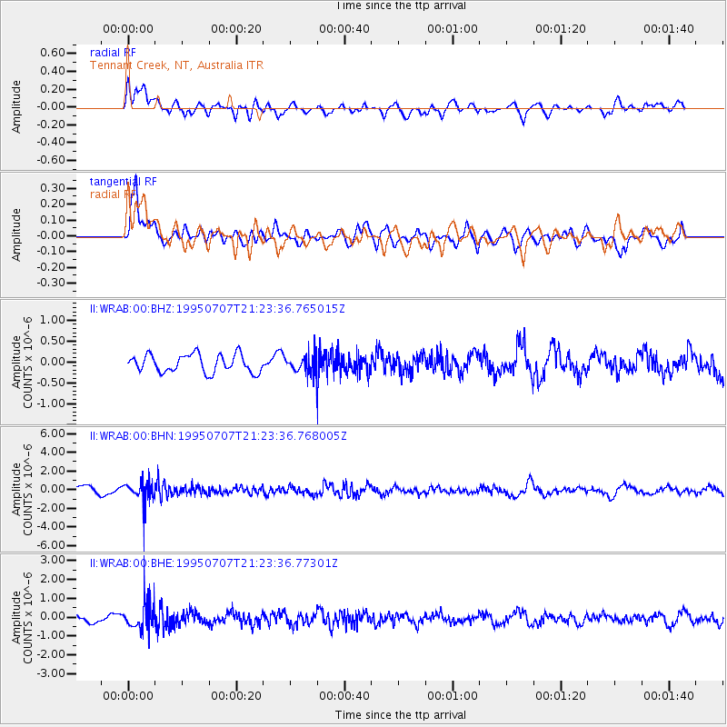
WRAB Tennant Creek, NT, Australia - Earthquake Result Viewer
*The percent match for this event was below the threshold and hence no stack was calculated.
| Earthquake location: |
Near S. Coast Of Honshu, Japan |
| Earthquake latitude/longitude: |
33.9/137.1 |
| Earthquake time(UTC): |
1995/07/07 (188) 21:15:18 GMT |
| Earthquake Depth: |
324 km |
| Earthquake Magnitude: |
5.8 MB, 6.0 UNKNOWN, 6.0 MW |
| Earthquake Catalog/Contributor: |
WHDF/NEIC |
|
| Network: |
II Global Seismograph Network (GSN - IRIS/IDA) |
| Station: |
WRAB Tennant Creek, NT, Australia |
| Lat/Lon: |
19.93 S/134.36 E |
| Elevation: |
366 m |
|
| Distance: |
53.6 deg |
| Az: |
183.227 deg |
| Baz: |
2.851 deg |
| Ray Param: |
$rayparam |
*The percent match for this event was below the threshold and hence was not used in the summary stack. |
|
| Radial Match: |
76.6497 % |
| Radial Bump: |
400 |
| Transverse Match: |
67.842186 % |
| Transverse Bump: |
400 |
| SOD ConfigId: |
4480 |
| Insert Time: |
2010-03-01 23:32:40.498 +0000 |
| GWidth: |
2.5 |
| Max Bumps: |
400 |
| Tol: |
0.001 |
|
Signal To Noise
| Channel | StoN | STA | LTA |
| II:WRAB:00:BHN:19950707T21:23:36.768005Z | 2.590122 | 1.2487333E-6 | 4.821137E-7 |
| II:WRAB:00:BHE:19950707T21:23:36.77301Z | 2.3032994 | 7.6579323E-7 | 3.3247662E-7 |
| II:WRAB:00:BHZ:19950707T21:23:36.765015Z | 0.98071307 | 2.0888454E-7 | 2.1299252E-7 |
| Arrivals |
| Ps | |
| PpPs | |
| PsPs/PpSs | |


