You are here: Home > Network List > II - Global Seismograph Network (GSN - IRIS/IDA) Stations List
> Station WRAB Tennant Creek, NT, Australia > Earthquake Result Viewer
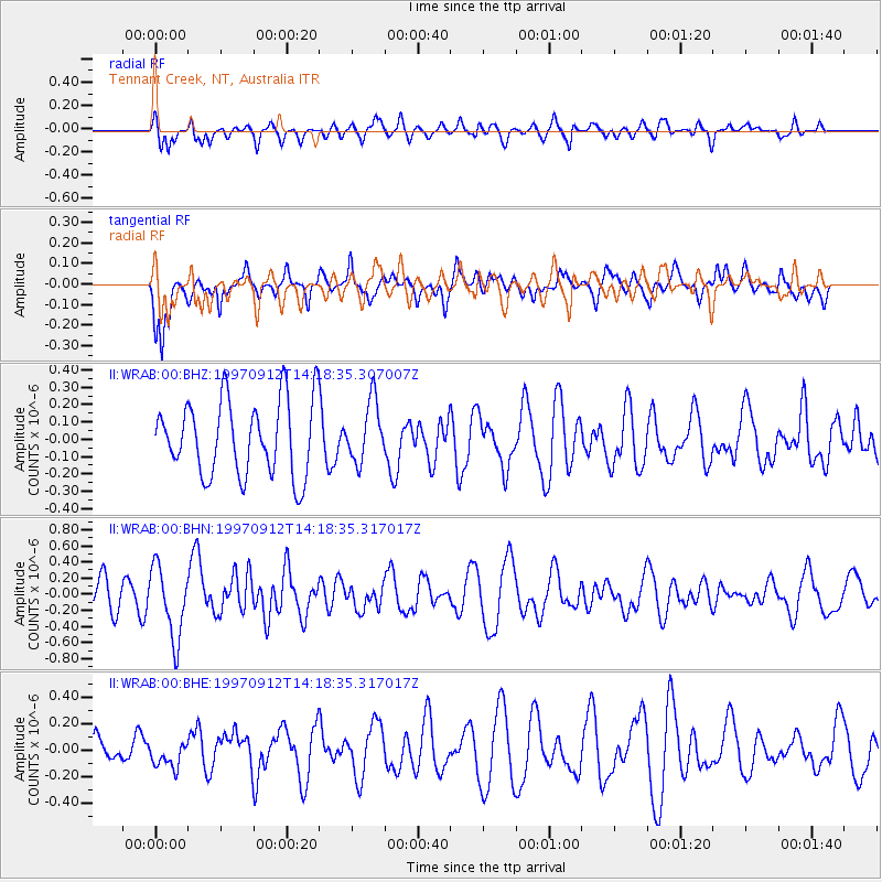
WRAB Tennant Creek, NT, Australia - Earthquake Result Viewer
*The percent match for this event was below the threshold and hence no stack was calculated.
| Earthquake location: |
Pacific-Antarctic Ridge |
| Earthquake latitude/longitude: |
-63.1/-164.3 |
| Earthquake time(UTC): |
1997/09/12 (255) 14:09:03 GMT |
| Earthquake Depth: |
10 km |
| Earthquake Magnitude: |
5.6 MS, 5.0 MB, 5.8 UNKNOWN, 5.8 MW |
| Earthquake Catalog/Contributor: |
WHDF/NEIC |
|
| Network: |
II Global Seismograph Network (GSN - IRIS/IDA) |
| Station: |
WRAB Tennant Creek, NT, Australia |
| Lat/Lon: |
19.93 S/134.36 E |
| Elevation: |
366 m |
|
| Distance: |
59.5 deg |
| Az: |
286.734 deg |
| Baz: |
152.442 deg |
| Ray Param: |
$rayparam |
*The percent match for this event was below the threshold and hence was not used in the summary stack. |
|
| Radial Match: |
65.670334 % |
| Radial Bump: |
400 |
| Transverse Match: |
58.564873 % |
| Transverse Bump: |
400 |
| SOD ConfigId: |
4480 |
| Insert Time: |
2010-03-01 23:32:45.947 +0000 |
| GWidth: |
2.5 |
| Max Bumps: |
400 |
| Tol: |
0.001 |
|
Signal To Noise
| Channel | StoN | STA | LTA |
| II:WRAB:00:BHN:19970912T14:18:35.317017Z | 2.0500376 | 4.4091087E-7 | 2.1507454E-7 |
| II:WRAB:00:BHE:19970912T14:18:35.317017Z | 0.7414504 | 9.9167394E-8 | 1.3374783E-7 |
| II:WRAB:00:BHZ:19970912T14:18:35.307007Z | 0.80646074 | 1.7404415E-7 | 2.1581229E-7 |
| Arrivals |
| Ps | |
| PpPs | |
| PsPs/PpSs | |


