You are here: Home > Network List > CI - Caltech Regional Seismic Network Stations List
> Station VCS Vincent Substation, Palmdale, CA, USA > Earthquake Result Viewer
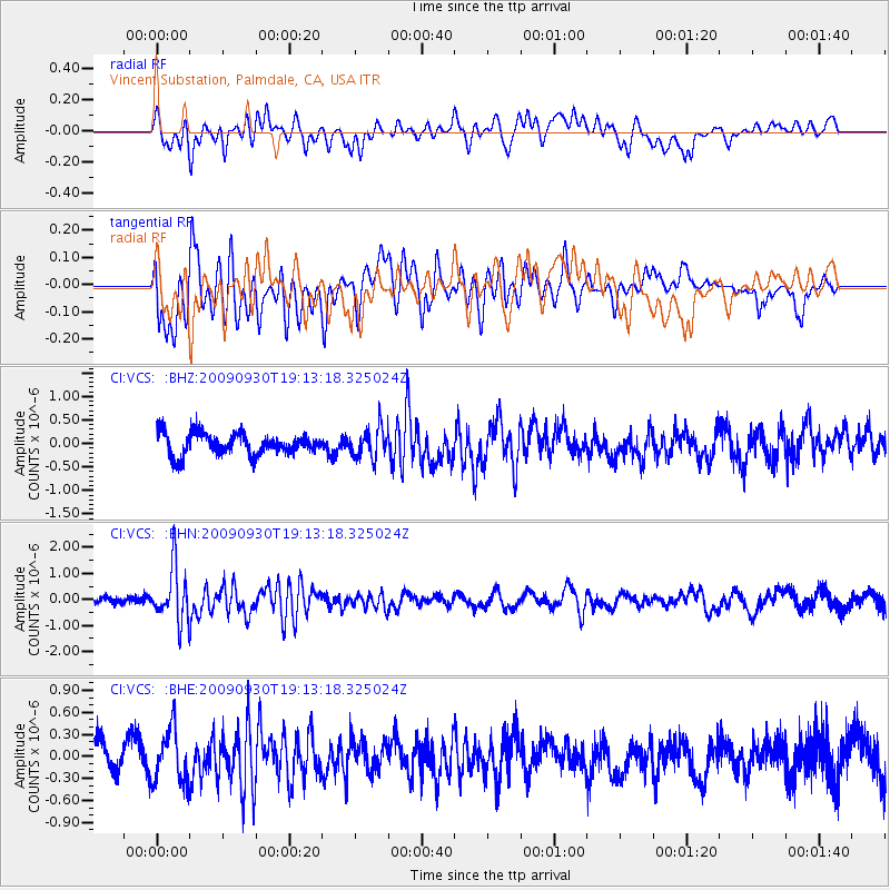
VCS Vincent Substation, Palmdale, CA, USA - Earthquake Result Viewer
*The percent match for this event was below the threshold and hence no stack was calculated.
| Earthquake location: |
Peru-Bolivia Border Region |
| Earthquake latitude/longitude: |
-15.6/-69.3 |
| Earthquake time(UTC): |
2009/09/30 (273) 19:03:17 GMT |
| Earthquake Depth: |
255 km |
| Earthquake Magnitude: |
5.9 MB, 5.8 MW |
| Earthquake Catalog/Contributor: |
WHDF/NEIC |
|
| Network: |
CI Caltech Regional Seismic Network |
| Station: |
VCS Vincent Substation, Palmdale, CA, USA |
| Lat/Lon: |
34.48 N/118.12 W |
| Elevation: |
991 m |
|
| Distance: |
68.0 deg |
| Az: |
317.899 deg |
| Baz: |
128.531 deg |
| Ray Param: |
$rayparam |
*The percent match for this event was below the threshold and hence was not used in the summary stack. |
|
| Radial Match: |
51.992954 % |
| Radial Bump: |
400 |
| Transverse Match: |
67.15655 % |
| Transverse Bump: |
400 |
| SOD ConfigId: |
2622 |
| Insert Time: |
2010-02-25 21:09:56.795 +0000 |
| GWidth: |
2.5 |
| Max Bumps: |
400 |
| Tol: |
0.001 |
|
Signal To Noise
| Channel | StoN | STA | LTA |
| CI:VCS: :BHN:20090930T19:13:18.325024Z | 6.8540845 | 1.0483316E-6 | 1.5294991E-7 |
| CI:VCS: :BHE:20090930T19:13:18.325024Z | 1.625144 | 3.6263384E-7 | 2.2313951E-7 |
| CI:VCS: :BHZ:20090930T19:13:18.325024Z | 1.399954 | 3.2157124E-7 | 2.297013E-7 |
| Arrivals |
| Ps | |
| PpPs | |
| PsPs/PpSs | |


