
HOPE Hope Point, South Georgia Island - Earthquake Result Viewer
| ||||||||||||||||||
| ||||||||||||||||||
| ||||||||||||||||||
|
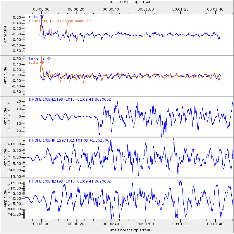
Signal To Noise
| Channel | StoN | STA | LTA |
| II:HOPE:10:BHN:19971015T01:09:41.862006Z | 2.1734726 | 3.4517948E-6 | 1.5881475E-6 |
| II:HOPE:10:BHE:19971015T01:09:41.862006Z | 2.5025804 | 5.8566507E-6 | 2.340245E-6 |
| II:HOPE:10:BHZ:19971015T01:09:41.862006Z | 4.090294 | 9.589005E-6 | 2.3443315E-6 |
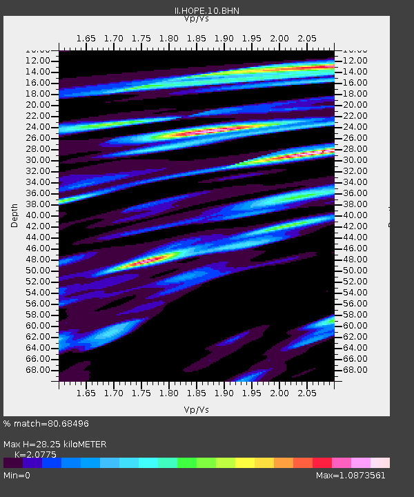
| Arrivals | |
| Ps | 6.7 SECOND |
| PpPs | 18 SECOND |
| PsPs/PpSs | 24 SECOND |

