HOPE Hope Point, South Georgia Island - Earthquake Result Viewer
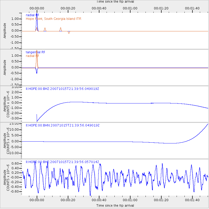
Earthquake location: South Island, New Zealand
Earthquake latitude/longitude: -44.8/167.5
Earthquake time(UTC): 2007/10/15 (288) 21:28:23 GMT
Earthquake Depth: 19 km
Earthquake Magnitude: 5.6 MB, 6.0 MS, 6.1 MW, 6.0 MW
Earthquake Catalog/Contributor: WHDF/NEIC
Network: II Global Seismograph Network (GSN - IRIS/IDA)
Station: HOPE Hope Point, South Georgia Island
Lat/Lon: 54.28 S/36.49 W
Elevation: 20 m
Distance: 79.2 deg
Az: 165.979 deg
Baz: 197.109 deg
Ray Param: 0.04910106
Estimated Moho Depth: 10.0 km
Estimated Crust Vp/Vs: 1.60
Assumed Crust Vp: 4.73 km/s
Estimated Crust Vs: 2.956 km/s
Estimated Crust Poisson's Ratio: 0.18
Radial Match: 99.999435 %
Radial Bump: 2
Transverse Match: 99.95293 %
Transverse Bump: 11
SOD ConfigId: 2564
Insert Time: 2010-03-01 23:33:15.892 +0000
GWidth: 2.5
Max Bumps: 400
Tol: 0.001

Signal To Noise

ChannelStoNSTALTA
II:HOPE:00:BHN:20071015T21:39:56.049019Z0.91139041.1321937E-61.2422709E-6
II:HOPE:00:BHE:20071015T21:39:56.057014Z1.25287714.1559494E-73.3171244E-7
II:HOPE:00:BHZ:20071015T21:39:56.049019Z0.911489841.0024008E-61.0997389E-6
Arrivals
Ps1.3 SECOND
PpPs5.4 SECOND
PsPs/PpSs6.7 SECOND