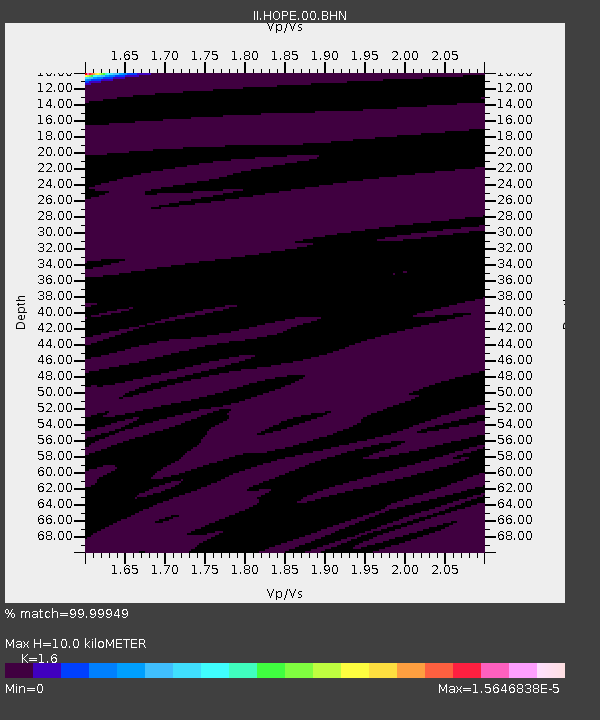
HOPE Hope Point, South Georgia Island - Earthquake Result Viewer
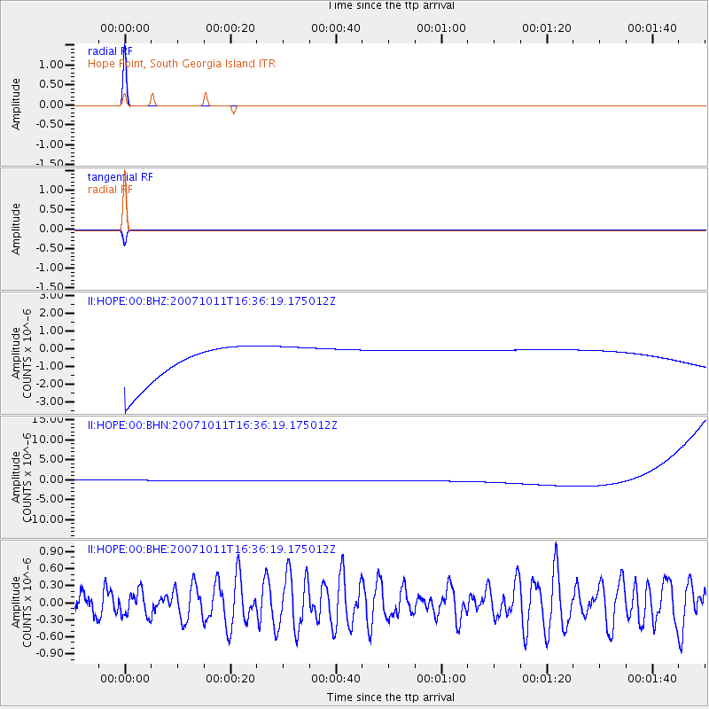
Earthquake location: Auckland Islands, N.Z. Region
Earthquake latitude/longitude: -49.1/164.3
Earthquake time(UTC): 2007/10/11 (284) 16:25:05 GMT
Earthquake Depth: 10 km
Earthquake Magnitude: 5.6 MW, 5.1 MS, 5.4 MB, 5.5 MW
Earthquake Catalog/Contributor: WHDF/NEIC
Network: II Global Seismograph Network (GSN - IRIS/IDA)
Station: HOPE Hope Point, South Georgia Island
Lat/Lon: 54.28 S/36.49 W
Elevation: 20 m
Distance: 75.6 deg
Az: 167.585 deg
Baz: 193.959 deg
Ray Param: 0.051589973
Estimated Moho Depth: 10.0 km
Estimated Crust Vp/Vs: 1.60
Assumed Crust Vp: 4.73 km/s
Estimated Crust Vs: 2.956 km/s
Estimated Crust Poisson's Ratio: 0.18
Radial Match: 99.99949 %
Radial Bump: 2
Transverse Match: 99.88158 %
Transverse Bump: 9
SOD ConfigId: 2564
Insert Time: 2010-03-01 23:33:20.662 +0000
GWidth: 2.5
Max Bumps: 400
Tol: 0.001

Signal To Noise

ChannelStoNSTALTA
II:HOPE:00:BHN:20071011T16:36:19.175012Z0.912509441.1315781E-61.2400727E-6
II:HOPE:00:BHE:20071011T16:36:19.175012Z0.809194152.1615404E-72.6712257E-7
II:HOPE:00:BHZ:20071011T16:36:19.175012Z0.910706641.0004107E-61.0984994E-6
Arrivals
Ps1.3 SECOND
PpPs5.4 SECOND
PsPs/PpSs6.7 SECOND