HOPE Hope Point, South Georgia Island - Earthquake Result Viewer
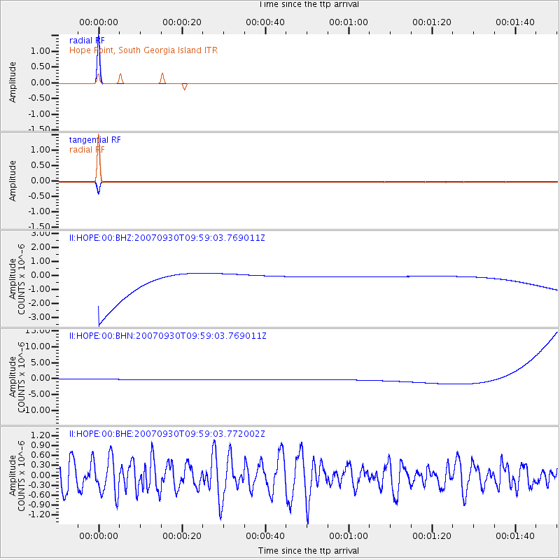
Earthquake location: Auckland Islands, N.Z. Region
Earthquake latitude/longitude: -49.1/164.1
Earthquake time(UTC): 2007/09/30 (273) 09:47:51 GMT
Earthquake Depth: 18 km
Earthquake Magnitude: 6.6 MB, 6.7 MS, 6.6 MW, 6.5 MW
Earthquake Catalog/Contributor: WHDF/NEIC
Network: II Global Seismograph Network (GSN - IRIS/IDA)
Station: HOPE Hope Point, South Georgia Island
Lat/Lon: 54.28 S/36.49 W
Elevation: 20 m
Distance: 75.5 deg
Az: 167.698 deg
Baz: 193.807 deg
Ray Param: 0.051612467
Estimated Moho Depth: 10.0 km
Estimated Crust Vp/Vs: 1.60
Assumed Crust Vp: 4.73 km/s
Estimated Crust Vs: 2.956 km/s
Estimated Crust Poisson's Ratio: 0.18
Radial Match: 99.99927 %
Radial Bump: 2
Transverse Match: 99.85389 %
Transverse Bump: 21
SOD ConfigId: 2564
Insert Time: 2010-03-01 23:33:21.584 +0000
GWidth: 2.5
Max Bumps: 400
Tol: 0.001

Signal To Noise

ChannelStoNSTALTA
II:HOPE:00:BHN:20070930T09:59:03.769011Z0.91116761.1304414E-61.2406514E-6
II:HOPE:00:BHE:20070930T09:59:03.772002Z1.44256665.481625E-73.7999112E-7
II:HOPE:00:BHZ:20070930T09:59:03.769011Z0.913203951.0035656E-61.0989501E-6
Arrivals
Ps1.3 SECOND
PpPs5.4 SECOND
PsPs/PpSs6.7 SECOND