HOPE Hope Point, South Georgia Island - Earthquake Result Viewer
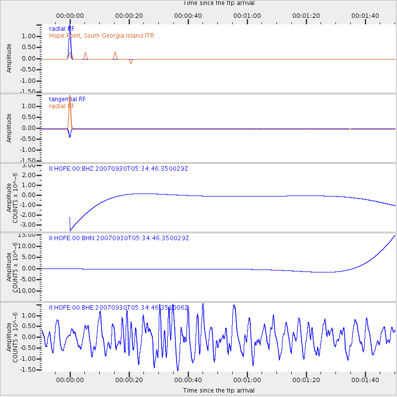
Earthquake location: Auckland Islands, N.Z. Region
Earthquake latitude/longitude: -49.3/164.1
Earthquake time(UTC): 2007/09/30 (273) 05:23:34 GMT
Earthquake Depth: 10 km
Earthquake Magnitude: 6.4 MB, 7.4 MS, 7.4 MW, 6.9 MW
Earthquake Catalog/Contributor: WHDF/NEIC
Network: II Global Seismograph Network (GSN - IRIS/IDA)
Station: HOPE Hope Point, South Georgia Island
Lat/Lon: 54.28 S/36.49 W
Elevation: 20 m
Distance: 75.4 deg
Az: 167.687 deg
Baz: 193.781 deg
Ray Param: 0.051716186
Estimated Moho Depth: 10.0 km
Estimated Crust Vp/Vs: 1.60
Assumed Crust Vp: 4.73 km/s
Estimated Crust Vs: 2.956 km/s
Estimated Crust Poisson's Ratio: 0.18
Radial Match: 99.99871 %
Radial Bump: 2
Transverse Match: 99.70896 %
Transverse Bump: 21
SOD ConfigId: 2564
Insert Time: 2010-03-01 23:33:23.378 +0000
GWidth: 2.5
Max Bumps: 400
Tol: 0.001

Signal To Noise

ChannelStoNSTALTA
II:HOPE:00:BHN:20070930T05:34:46.350029Z0.910534561.1302512E-61.2413051E-6
II:HOPE:00:BHE:20070930T05:34:46.351006Z0.72633482.870782E-73.9524224E-7
II:HOPE:00:BHZ:20070930T05:34:46.350029Z0.910251861.000985E-61.0996793E-6
Arrivals
Ps1.3 SECOND
PpPs5.4 SECOND
PsPs/PpSs6.7 SECOND