You are here: Home > Network List > II - Global Seismograph Network (GSN - IRIS/IDA) Stations List
> Station HOPE Hope Point, South Georgia Island > Earthquake Result Viewer
HOPE Hope Point, South Georgia Island - Earthquake Result Viewer
| Earthquake location: |
West Of Macquarie Island |
| Earthquake latitude/longitude: |
-60.5/153.8 |
| Earthquake time(UTC): |
2007/08/13 (225) 10:27:23 GMT |
| Earthquake Depth: |
10 km |
| Earthquake Magnitude: |
5.6 MB, 5.6 MS, 6.1 MW, 5.9 MW |
| Earthquake Catalog/Contributor: |
WHDF/NEIC |
|
| Network: |
II Global Seismograph Network (GSN - IRIS/IDA) |
| Station: |
HOPE Hope Point, South Georgia Island |
| Lat/Lon: |
54.28 S/36.49 W |
| Elevation: |
20 m |
|
| Distance: |
65.2 deg |
| Az: |
173.386 deg |
| Baz: |
185.57 deg |
| Ray Param: |
0.058413558 |
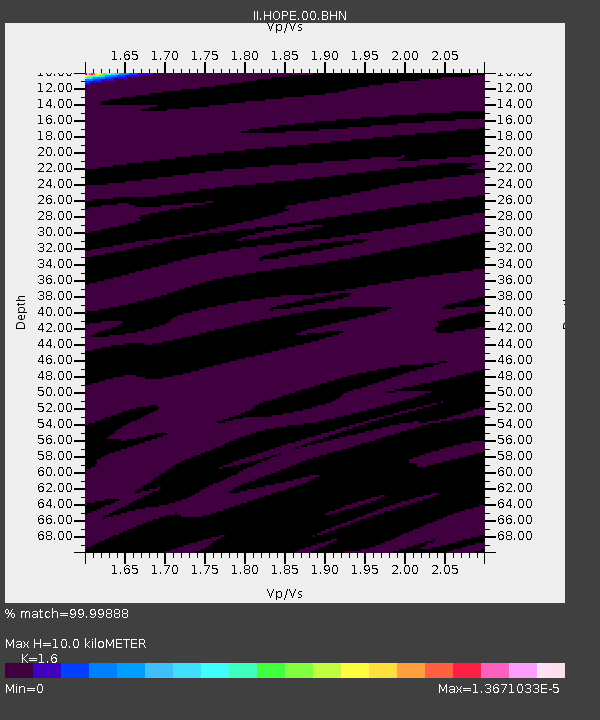
| Estimated Moho Depth: |
10.0 km |
| Estimated Crust Vp/Vs: |
1.60 |
| Assumed Crust Vp: |
4.73 km/s |
| Estimated Crust Vs: |
2.956 km/s |
| Estimated Crust Poisson's Ratio: |
0.18 |
|
| Radial Match: |
99.99888 % |
| Radial Bump: |
2 |
| Transverse Match: |
93.6527 % |
| Transverse Bump: |
92 |
| SOD ConfigId: |
2564 |
| Insert Time: |
2010-03-01 23:33:26.588 +0000 |
| GWidth: |
2.5 |
| Max Bumps: |
400 |
| Tol: |
0.001 |
|
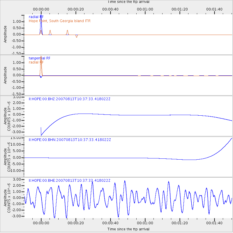
Signal To Noise
| Channel | StoN | STA | LTA |
| II:HOPE:00:BHN:20070813T10:37:33.418022Z | 0.9111708 | 1.1297437E-6 | 1.2398815E-6 |
| II:HOPE:00:BHE:20070813T10:37:33.418022Z | 1.2379638 | 1.404957E-6 | 1.1348934E-6 |
| II:HOPE:00:BHZ:20070813T10:37:33.418022Z | 0.91135633 | 1.0004591E-6 | 1.0977693E-6 |
| Arrivals |
| Ps | 1.3 SECOND |
| PpPs | 5.4 SECOND |
| PsPs/PpSs | 6.7 SECOND |


