You are here: Home > Network List > TA - USArray Transportable Network (new EarthScope stations) Stations List
> Station L04D Klamath Falls, OR, USA > Earthquake Result Viewer
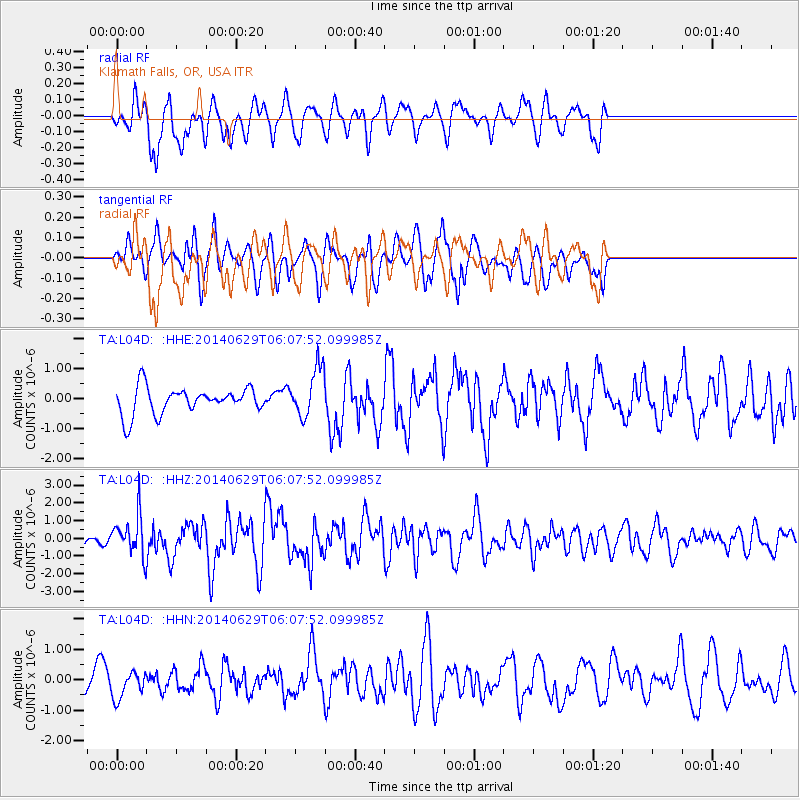
L04D Klamath Falls, OR, USA - Earthquake Result Viewer
*The percent match for this event was below the threshold and hence no stack was calculated.
| Earthquake location: |
Volcano Islands, Japan Region |
| Earthquake latitude/longitude: |
24.4/142.6 |
| Earthquake time(UTC): |
2014/06/29 (180) 05:56:31 GMT |
| Earthquake Depth: |
43 km |
| Earthquake Magnitude: |
6.2 MWP |
| Earthquake Catalog/Contributor: |
NEIC PDE/NEIC COMCAT |
|
| Network: |
TA USArray Transportable Network (new EarthScope stations) |
| Station: |
L04D Klamath Falls, OR, USA |
| Lat/Lon: |
42.22 N/122.30 W |
| Elevation: |
1437 m |
|
| Distance: |
77.6 deg |
| Az: |
49.25 deg |
| Baz: |
291.597 deg |
| Ray Param: |
$rayparam |
*The percent match for this event was below the threshold and hence was not used in the summary stack. |
|
| Radial Match: |
55.44443 % |
| Radial Bump: |
400 |
| Transverse Match: |
55.03894 % |
| Transverse Bump: |
400 |
| SOD ConfigId: |
751272 |
| Insert Time: |
2014-07-13 06:44:20.755 +0000 |
| GWidth: |
2.5 |
| Max Bumps: |
400 |
| Tol: |
0.001 |
|
Signal To Noise
| Channel | StoN | STA | LTA |
| TA:L04D: :HHZ:20140629T06:07:52.099985Z | 2.7102787 | 1.140368E-6 | 4.2075672E-7 |
| TA:L04D: :HHN:20140629T06:07:52.099985Z | 0.5654333 | 4.4418195E-7 | 7.855603E-7 |
| TA:L04D: :HHE:20140629T06:07:52.099985Z | 1.8314772 | 8.1886884E-7 | 4.471084E-7 |
| Arrivals |
| Ps | |
| PpPs | |
| PsPs/PpSs | |


