You are here: Home > Network List > US - United States National Seismic Network Stations List
> Station HAWA Hanford, Washington, USA > Earthquake Result Viewer
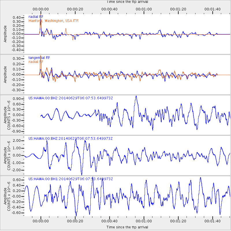
HAWA Hanford, Washington, USA - Earthquake Result Viewer
*The percent match for this event was below the threshold and hence no stack was calculated.
| Earthquake location: |
Volcano Islands, Japan Region |
| Earthquake latitude/longitude: |
24.4/142.6 |
| Earthquake time(UTC): |
2014/06/29 (180) 05:56:31 GMT |
| Earthquake Depth: |
43 km |
| Earthquake Magnitude: |
6.2 MWP |
| Earthquake Catalog/Contributor: |
NEIC PDE/NEIC COMCAT |
|
| Network: |
US United States National Seismic Network |
| Station: |
HAWA Hanford, Washington, USA |
| Lat/Lon: |
46.39 N/119.53 W |
| Elevation: |
364 m |
|
| Distance: |
77.9 deg |
| Az: |
44.528 deg |
| Baz: |
292.524 deg |
| Ray Param: |
$rayparam |
*The percent match for this event was below the threshold and hence was not used in the summary stack. |
|
| Radial Match: |
73.87342 % |
| Radial Bump: |
400 |
| Transverse Match: |
74.43564 % |
| Transverse Bump: |
400 |
| SOD ConfigId: |
751272 |
| Insert Time: |
2014-07-13 06:47:12.405 +0000 |
| GWidth: |
2.5 |
| Max Bumps: |
400 |
| Tol: |
0.001 |
|
Signal To Noise
| Channel | StoN | STA | LTA |
| US:HAWA:00:BHZ:20140629T06:07:53.649973Z | 3.5576286 | 9.192895E-7 | 2.5839952E-7 |
| US:HAWA:00:BH1:20140629T06:07:53.649973Z | 1.0092233 | 1.7767398E-7 | 1.7605021E-7 |
| US:HAWA:00:BH2:20140629T06:07:53.649973Z | 0.9841523 | 1.548482E-7 | 1.573417E-7 |
| Arrivals |
| Ps | |
| PpPs | |
| PsPs/PpSs | |


