You are here: Home > Network List > II - Global Seismograph Network (GSN - IRIS/IDA) Stations List
> Station HOPE Hope Point, South Georgia Island > Earthquake Result Viewer
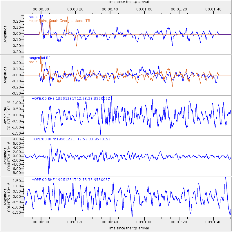
HOPE Hope Point, South Georgia Island - Earthquake Result Viewer
*The percent match for this event was below the threshold and hence no stack was calculated.
| Earthquake location: |
Mexico-Guatemala Border Region |
| Earthquake latitude/longitude: |
15.8/-93.0 |
| Earthquake time(UTC): |
1996/12/31 (366) 12:41:42 GMT |
| Earthquake Depth: |
100 km |
| Earthquake Magnitude: |
5.4 MB, 6.3 UNKNOWN, 6.3 MW |
| Earthquake Catalog/Contributor: |
WHDF/NEIC |
|
| Network: |
II Global Seismograph Network (GSN - IRIS/IDA) |
| Station: |
HOPE Hope Point, South Georgia Island |
| Lat/Lon: |
54.28 S/36.49 W |
| Elevation: |
20 m |
|
| Distance: |
84.7 deg |
| Az: |
150.597 deg |
| Baz: |
306.3 deg |
| Ray Param: |
$rayparam |
*The percent match for this event was below the threshold and hence was not used in the summary stack. |
|
| Radial Match: |
62.45887 % |
| Radial Bump: |
400 |
| Transverse Match: |
61.176853 % |
| Transverse Bump: |
400 |
| SOD ConfigId: |
4480 |
| Insert Time: |
2010-03-01 23:34:12.324 +0000 |
| GWidth: |
2.5 |
| Max Bumps: |
400 |
| Tol: |
0.001 |
|
Signal To Noise
| Channel | StoN | STA | LTA |
| II:HOPE:00:BHN:19961231T12:53:33.957019Z | 4.528115 | 2.520406E-6 | 5.566127E-7 |
| II:HOPE:00:BHE:19961231T12:53:33.955005Z | 1.2458032 | 5.0661345E-7 | 4.0665606E-7 |
| II:HOPE:00:BHZ:19961231T12:53:33.955005Z | 0.9195869 | 5.161187E-7 | 5.612506E-7 |
| Arrivals |
| Ps | |
| PpPs | |
| PsPs/PpSs | |


