You are here: Home > Network List > II - Global Seismograph Network (GSN - IRIS/IDA) Stations List
> Station HOPE Hope Point, South Georgia Island > Earthquake Result Viewer
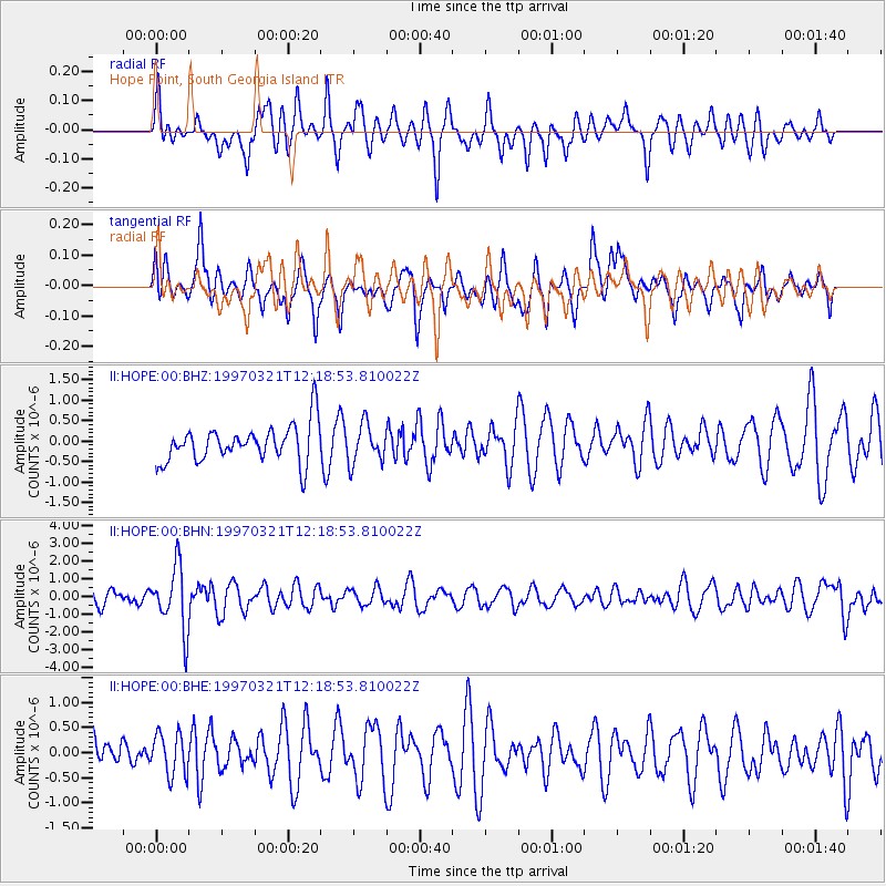
HOPE Hope Point, South Georgia Island - Earthquake Result Viewer
*The percent match for this event was below the threshold and hence no stack was calculated.
| Earthquake location: |
Kermadec Islands Region |
| Earthquake latitude/longitude: |
-31.2/179.6 |
| Earthquake time(UTC): |
1997/03/21 (080) 12:07:17 GMT |
| Earthquake Depth: |
449 km |
| Earthquake Magnitude: |
5.6 MB, 6.3 UNKNOWN, 6.2 MW |
| Earthquake Catalog/Contributor: |
WHDF/NEIC |
|
| Network: |
II Global Seismograph Network (GSN - IRIS/IDA) |
| Station: |
HOPE Hope Point, South Georgia Island |
| Lat/Lon: |
54.28 S/36.49 W |
| Elevation: |
20 m |
|
| Distance: |
89.4 deg |
| Az: |
159.782 deg |
| Baz: |
210.348 deg |
| Ray Param: |
$rayparam |
*The percent match for this event was below the threshold and hence was not used in the summary stack. |
|
| Radial Match: |
59.016136 % |
| Radial Bump: |
400 |
| Transverse Match: |
54.478664 % |
| Transverse Bump: |
400 |
| SOD ConfigId: |
4480 |
| Insert Time: |
2010-03-01 23:34:19.834 +0000 |
| GWidth: |
2.5 |
| Max Bumps: |
400 |
| Tol: |
0.001 |
|
Signal To Noise
| Channel | StoN | STA | LTA |
| II:HOPE:00:BHN:19970321T12:18:53.810022Z | 3.8835492 | 1.7579538E-6 | 4.5266677E-7 |
| II:HOPE:00:BHE:19970321T12:18:53.810022Z | 1.038759 | 4.1817546E-7 | 4.0257217E-7 |
| II:HOPE:00:BHZ:19970321T12:18:53.810022Z | 1.0378177 | 4.6919777E-7 | 4.5210038E-7 |
| Arrivals |
| Ps | |
| PpPs | |
| PsPs/PpSs | |


