You are here: Home > Network List > UW - Pacific Northwest Regional Seismic Network Stations List
> Station MRBL Marblemount, WA, USA > Earthquake Result Viewer
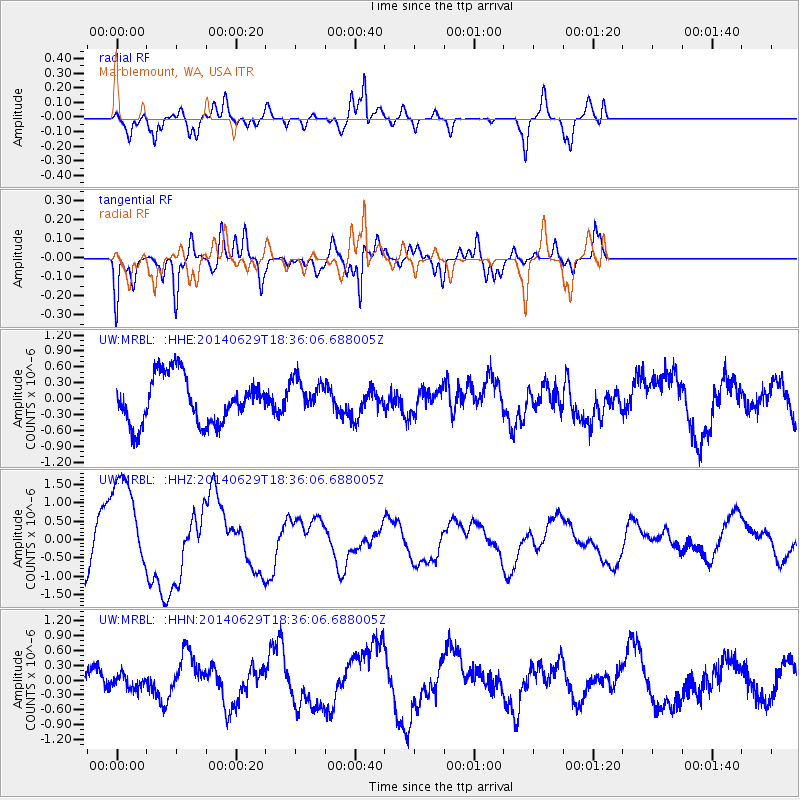
MRBL Marblemount, WA, USA - Earthquake Result Viewer
*The percent match for this event was below the threshold and hence no stack was calculated.
| Earthquake location: |
Tonga Islands |
| Earthquake latitude/longitude: |
-15.4/-175.4 |
| Earthquake time(UTC): |
2014/06/29 (180) 18:24:30 GMT |
| Earthquake Depth: |
10 km |
| Earthquake Magnitude: |
5.6 MB |
| Earthquake Catalog/Contributor: |
NEIC PDE/NEIC COMCAT |
|
| Network: |
UW Pacific Northwest Regional Seismic Network |
| Station: |
MRBL Marblemount, WA, USA |
| Lat/Lon: |
48.52 N/121.48 W |
| Elevation: |
75 m |
|
| Distance: |
79.6 deg |
| Az: |
33.137 deg |
| Baz: |
232.486 deg |
| Ray Param: |
$rayparam |
*The percent match for this event was below the threshold and hence was not used in the summary stack. |
|
| Radial Match: |
67.33235 % |
| Radial Bump: |
400 |
| Transverse Match: |
61.72856 % |
| Transverse Bump: |
400 |
| SOD ConfigId: |
751272 |
| Insert Time: |
2014-07-13 18:47:10.889 +0000 |
| GWidth: |
2.5 |
| Max Bumps: |
400 |
| Tol: |
0.001 |
|
Signal To Noise
| Channel | StoN | STA | LTA |
| UW:MRBL: :HHZ:20140629T18:36:06.688005Z | 2.066085 | 1.4016539E-6 | 6.784105E-7 |
| UW:MRBL: :HHN:20140629T18:36:06.688005Z | 0.4343185 | 1.4086842E-7 | 3.2434357E-7 |
| UW:MRBL: :HHE:20140629T18:36:06.688005Z | 0.742574 | 3.266674E-7 | 4.3991224E-7 |
| Arrivals |
| Ps | |
| PpPs | |
| PsPs/PpSs | |


