You are here: Home > Network List > IU - Global Seismograph Network (GSN - IRIS/USGS) Stations List
> Station RSSD Black Hills, South Dakota, USA > Earthquake Result Viewer
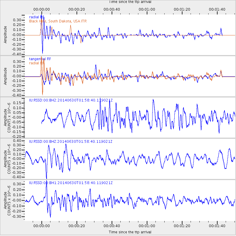
RSSD Black Hills, South Dakota, USA - Earthquake Result Viewer
*The percent match for this event was below the threshold and hence no stack was calculated.
| Earthquake location: |
North Of Ascension Island |
| Earthquake latitude/longitude: |
0.0/-17.3 |
| Earthquake time(UTC): |
2014/06/30 (181) 01:46:23 GMT |
| Earthquake Depth: |
8.0 km |
| Earthquake Magnitude: |
5.8 MB |
| Earthquake Catalog/Contributor: |
NEIC PDE/NEIC COMCAT |
|
| Network: |
IU Global Seismograph Network (GSN - IRIS/USGS) |
| Station: |
RSSD Black Hills, South Dakota, USA |
| Lat/Lon: |
44.12 N/104.04 W |
| Elevation: |
2090 m |
|
| Distance: |
87.6 deg |
| Az: |
313.975 deg |
| Baz: |
92.268 deg |
| Ray Param: |
$rayparam |
*The percent match for this event was below the threshold and hence was not used in the summary stack. |
|
| Radial Match: |
60.984425 % |
| Radial Bump: |
400 |
| Transverse Match: |
56.36167 % |
| Transverse Bump: |
400 |
| SOD ConfigId: |
751272 |
| Insert Time: |
2014-07-14 02:07:59.003 +0000 |
| GWidth: |
2.5 |
| Max Bumps: |
400 |
| Tol: |
0.001 |
|
Signal To Noise
| Channel | StoN | STA | LTA |
| IU:RSSD:00:BHZ:20140630T01:58:40.119021Z | 1.8130379 | 1.6800445E-7 | 9.266461E-8 |
| IU:RSSD:00:BH1:20140630T01:58:40.119021Z | 2.7738957 | 1.3525985E-7 | 4.8761695E-8 |
| IU:RSSD:00:BH2:20140630T01:58:40.119021Z | 2.009961 | 8.3917584E-8 | 4.1750855E-8 |
| Arrivals |
| Ps | |
| PpPs | |
| PsPs/PpSs | |


