You are here: Home > Network List > TA - USArray Transportable Network (new EarthScope stations) Stations List
> Station D49A Beulah Township, ON, CAN > Earthquake Result Viewer
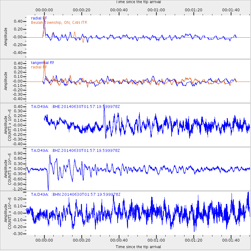
D49A Beulah Township, ON, CAN - Earthquake Result Viewer
*The percent match for this event was below the threshold and hence no stack was calculated.
| Earthquake location: |
North Of Ascension Island |
| Earthquake latitude/longitude: |
0.0/-17.3 |
| Earthquake time(UTC): |
2014/06/30 (181) 01:46:23 GMT |
| Earthquake Depth: |
8.0 km |
| Earthquake Magnitude: |
5.8 MB |
| Earthquake Catalog/Contributor: |
NEIC PDE/NEIC COMCAT |
|
| Network: |
TA USArray Transportable Network (new EarthScope stations) |
| Station: |
D49A Beulah Township, ON, CAN |
| Lat/Lon: |
47.27 N/81.36 W |
| Elevation: |
416 m |
|
| Distance: |
72.6 deg |
| Az: |
320.101 deg |
| Baz: |
109.619 deg |
| Ray Param: |
$rayparam |
*The percent match for this event was below the threshold and hence was not used in the summary stack. |
|
| Radial Match: |
66.980804 % |
| Radial Bump: |
400 |
| Transverse Match: |
54.241016 % |
| Transverse Bump: |
400 |
| SOD ConfigId: |
751272 |
| Insert Time: |
2014-07-14 02:24:50.007 +0000 |
| GWidth: |
2.5 |
| Max Bumps: |
400 |
| Tol: |
0.001 |
|
Signal To Noise
| Channel | StoN | STA | LTA |
| TA:D49A: :BHZ:20140630T01:57:19.599978Z | 7.212537 | 4.3688303E-7 | 6.0572724E-8 |
| TA:D49A: :BHN:20140630T01:57:19.599978Z | 1.4981946 | 8.664369E-8 | 5.7832064E-8 |
| TA:D49A: :BHE:20140630T01:57:19.599978Z | 1.8439044 | 1.5268698E-7 | 8.2806345E-8 |
| Arrivals |
| Ps | |
| PpPs | |
| PsPs/PpSs | |


