You are here: Home > Network List > TA - USArray Transportable Network (new EarthScope stations) Stations List
> Station E62A Clayton Lake, ME, USA > Earthquake Result Viewer
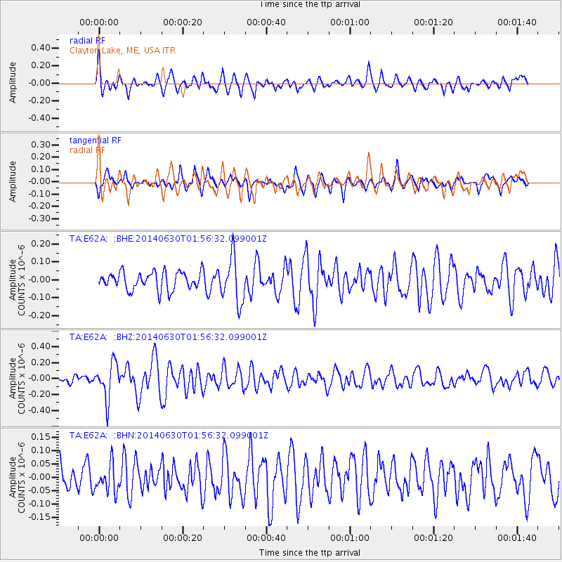
E62A Clayton Lake, ME, USA - Earthquake Result Viewer
*The percent match for this event was below the threshold and hence no stack was calculated.
| Earthquake location: |
North Of Ascension Island |
| Earthquake latitude/longitude: |
0.0/-17.3 |
| Earthquake time(UTC): |
2014/06/30 (181) 01:46:23 GMT |
| Earthquake Depth: |
8.0 km |
| Earthquake Magnitude: |
5.8 MB |
| Earthquake Catalog/Contributor: |
NEIC PDE/NEIC COMCAT |
|
| Network: |
TA USArray Transportable Network (new EarthScope stations) |
| Station: |
E62A Clayton Lake, ME, USA |
| Lat/Lon: |
46.62 N/69.52 W |
| Elevation: |
356 m |
|
| Distance: |
65.0 deg |
| Az: |
323.064 deg |
| Baz: |
119.327 deg |
| Ray Param: |
$rayparam |
*The percent match for this event was below the threshold and hence was not used in the summary stack. |
|
| Radial Match: |
59.026043 % |
| Radial Bump: |
400 |
| Transverse Match: |
61.19613 % |
| Transverse Bump: |
400 |
| SOD ConfigId: |
751272 |
| Insert Time: |
2014-07-14 02:26:32.310 +0000 |
| GWidth: |
2.5 |
| Max Bumps: |
400 |
| Tol: |
0.001 |
|
Signal To Noise
| Channel | StoN | STA | LTA |
| TA:E62A: :BHZ:20140630T01:56:32.099001Z | 5.5107756 | 2.3095197E-7 | 4.1909157E-8 |
| TA:E62A: :BHN:20140630T01:56:32.099001Z | 1.1392167 | 5.1591226E-8 | 4.5286576E-8 |
| TA:E62A: :BHE:20140630T01:56:32.099001Z | 2.653958 | 1.297644E-7 | 4.889467E-8 |
| Arrivals |
| Ps | |
| PpPs | |
| PsPs/PpSs | |


