You are here: Home > Network List > TA - USArray Transportable Network (new EarthScope stations) Stations List
> Station Q53A Leroy, WV, USA > Earthquake Result Viewer
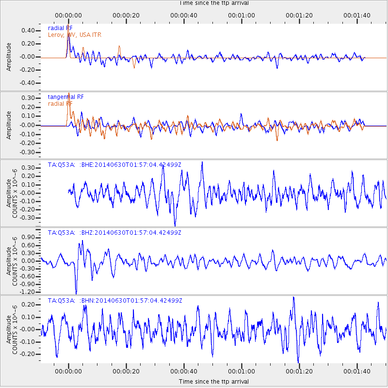
Q53A Leroy, WV, USA - Earthquake Result Viewer
*The percent match for this event was below the threshold and hence no stack was calculated.
| Earthquake location: |
North Of Ascension Island |
| Earthquake latitude/longitude: |
0.0/-17.3 |
| Earthquake time(UTC): |
2014/06/30 (181) 01:46:23 GMT |
| Earthquake Depth: |
8.0 km |
| Earthquake Magnitude: |
5.8 MB |
| Earthquake Catalog/Contributor: |
NEIC PDE/NEIC COMCAT |
|
| Network: |
TA USArray Transportable Network (new EarthScope stations) |
| Station: |
Q53A Leroy, WV, USA |
| Lat/Lon: |
38.86 N/81.53 W |
| Elevation: |
310 m |
|
| Distance: |
70.1 deg |
| Az: |
311.629 deg |
| Baz: |
106.79 deg |
| Ray Param: |
$rayparam |
*The percent match for this event was below the threshold and hence was not used in the summary stack. |
|
| Radial Match: |
64.536446 % |
| Radial Bump: |
400 |
| Transverse Match: |
58.168144 % |
| Transverse Bump: |
400 |
| SOD ConfigId: |
751272 |
| Insert Time: |
2014-07-14 02:36:51.735 +0000 |
| GWidth: |
2.5 |
| Max Bumps: |
400 |
| Tol: |
0.001 |
|
Signal To Noise
| Channel | StoN | STA | LTA |
| TA:Q53A: :BHZ:20140630T01:57:04.42499Z | 4.7439303 | 4.7070782E-7 | 9.922317E-8 |
| TA:Q53A: :BHN:20140630T01:57:04.42499Z | 0.89637405 | 7.270464E-8 | 8.1109704E-8 |
| TA:Q53A: :BHE:20140630T01:57:04.42499Z | 2.1975842 | 1.561342E-7 | 7.104812E-8 |
| Arrivals |
| Ps | |
| PpPs | |
| PsPs/PpSs | |


