You are here: Home > Network List > US - United States National Seismic Network Stations List
> Station DGMT Dagmar, Montana, USA > Earthquake Result Viewer
DGMT Dagmar, Montana, USA - Earthquake Result Viewer
*The percent match for this event was below the threshold and hence no stack was calculated.
| Earthquake location: |
North Of Ascension Island |
| Earthquake latitude/longitude: |
0.0/-17.3 |
| Earthquake time(UTC): |
2014/06/30 (181) 01:46:23 GMT |
| Earthquake Depth: |
8.0 km |
| Earthquake Magnitude: |
5.8 MB |
| Earthquake Catalog/Contributor: |
NEIC PDE/NEIC COMCAT |
|
| Network: |
US United States National Seismic Network |
| Station: |
DGMT Dagmar, Montana, USA |
| Lat/Lon: |
48.47 N/104.20 W |
| Elevation: |
0.0 m |
|
| Distance: |
87.9 deg |
| Az: |
318.321 deg |
| Baz: |
92.325 deg |
| Ray Param: |
$rayparam |
*The percent match for this event was below the threshold and hence was not used in the summary stack. |
|
| Radial Match: |
42.00886 % |
| Radial Bump: |
400 |
| Transverse Match: |
49.114983 % |
| Transverse Bump: |
400 |
| SOD ConfigId: |
751272 |
| Insert Time: |
2014-07-14 02:43:15.081 +0000 |
| GWidth: |
2.5 |
| Max Bumps: |
400 |
| Tol: |
0.001 |
|
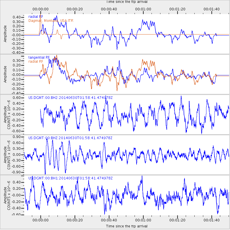
Signal To Noise
| Channel | StoN | STA | LTA |
| US:DGMT:00:BHZ:20140630T01:58:41.474978Z | 3.8399708 | 4.182474E-7 | 1.0891942E-7 |
| US:DGMT:00:BH1:20140630T01:58:41.474978Z | 1.2328728 | 2.3319177E-7 | 1.8914503E-7 |
| US:DGMT:00:BH2:20140630T01:58:41.474978Z | 1.2488512 | 2.8364016E-7 | 2.2712086E-7 |
| Arrivals |
| Ps | |
| PpPs | |
| PsPs/PpSs | |


