You are here: Home > Network List > II - Global Seismograph Network (GSN - IRIS/IDA) Stations List
> Station WRAB Tennant Creek, NT, Australia > Earthquake Result Viewer
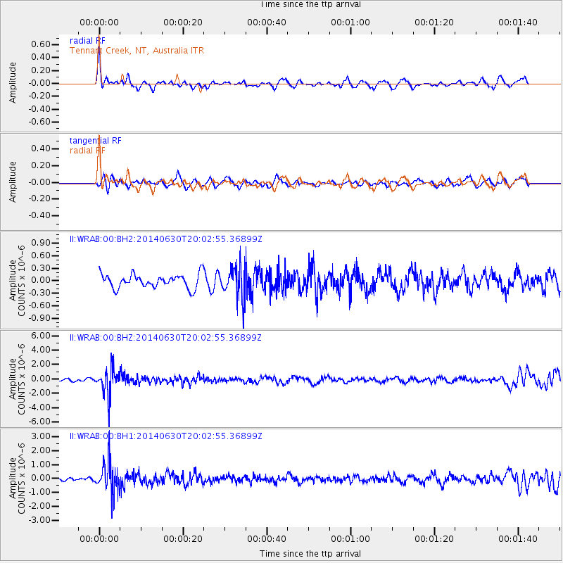
WRAB Tennant Creek, NT, Australia - Earthquake Result Viewer
*The percent match for this event was below the threshold and hence no stack was calculated.
| Earthquake location: |
Bonin Islands, Japan Region |
| Earthquake latitude/longitude: |
28.4/138.9 |
| Earthquake time(UTC): |
2014/06/30 (181) 19:55:32 GMT |
| Earthquake Depth: |
512 km |
| Earthquake Magnitude: |
6.2 MWB |
| Earthquake Catalog/Contributor: |
NEIC PDE/NEIC COMCAT |
|
| Network: |
II Global Seismograph Network (GSN - IRIS/IDA) |
| Station: |
WRAB Tennant Creek, NT, Australia |
| Lat/Lon: |
19.93 S/134.36 E |
| Elevation: |
366 m |
|
| Distance: |
48.2 deg |
| Az: |
185.688 deg |
| Baz: |
5.327 deg |
| Ray Param: |
$rayparam |
*The percent match for this event was below the threshold and hence was not used in the summary stack. |
|
| Radial Match: |
67.5239 % |
| Radial Bump: |
337 |
| Transverse Match: |
64.74851 % |
| Transverse Bump: |
400 |
| SOD ConfigId: |
751272 |
| Insert Time: |
2014-07-14 20:32:00.829 +0000 |
| GWidth: |
2.5 |
| Max Bumps: |
400 |
| Tol: |
0.001 |
|
Signal To Noise
| Channel | StoN | STA | LTA |
| II:WRAB:00:BHZ:20140630T20:02:55.36899Z | 11.139291 | 1.8593577E-6 | 1.6691885E-7 |
| II:WRAB:00:BH1:20140630T20:02:55.36899Z | 6.6765003 | 1.1157742E-6 | 1.6711962E-7 |
| II:WRAB:00:BH2:20140630T20:02:55.36899Z | 2.3068938 | 3.7753534E-7 | 1.6365529E-7 |
| Arrivals |
| Ps | |
| PpPs | |
| PsPs/PpSs | |


