You are here: Home > Network List > TA - USArray Transportable Network (new EarthScope stations) Stations List
> Station J01E Myrtle Point, OR, USA > Earthquake Result Viewer
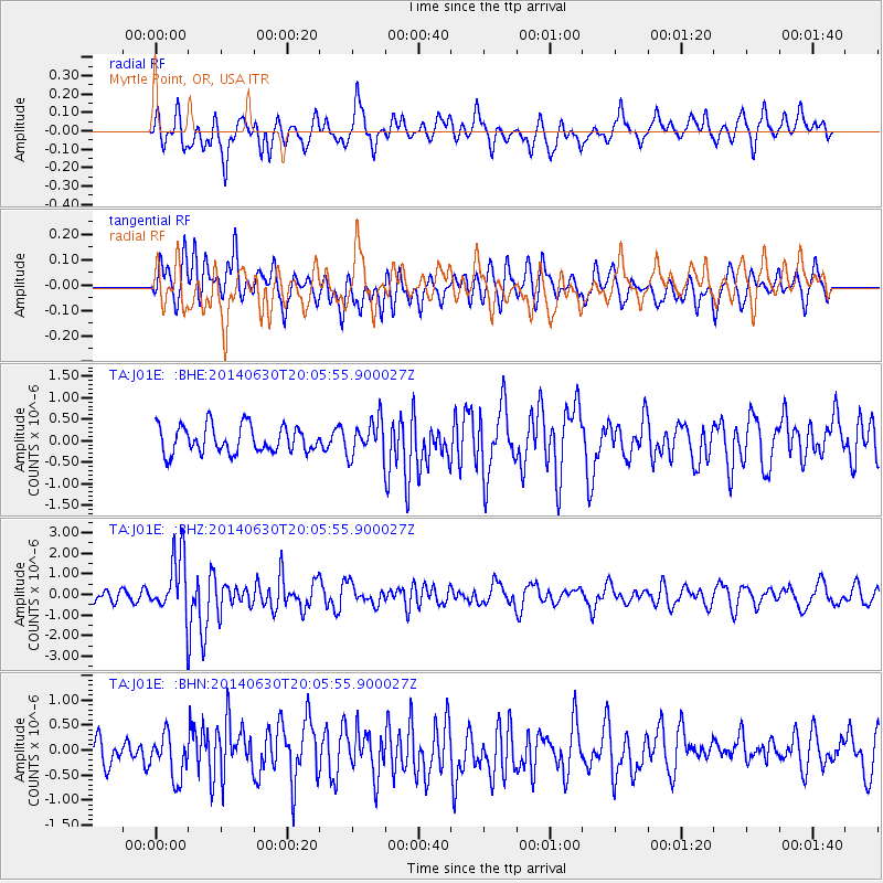
J01E Myrtle Point, OR, USA - Earthquake Result Viewer
*The percent match for this event was below the threshold and hence no stack was calculated.
| Earthquake location: |
Bonin Islands, Japan Region |
| Earthquake latitude/longitude: |
28.4/138.9 |
| Earthquake time(UTC): |
2014/06/30 (181) 19:55:32 GMT |
| Earthquake Depth: |
512 km |
| Earthquake Magnitude: |
6.2 MWB |
| Earthquake Catalog/Contributor: |
NEIC PDE/NEIC COMCAT |
|
| Network: |
TA USArray Transportable Network (new EarthScope stations) |
| Station: |
J01E Myrtle Point, OR, USA |
| Lat/Lon: |
43.16 N/123.93 W |
| Elevation: |
128 m |
|
| Distance: |
76.0 deg |
| Az: |
48.419 deg |
| Baz: |
295.711 deg |
| Ray Param: |
$rayparam |
*The percent match for this event was below the threshold and hence was not used in the summary stack. |
|
| Radial Match: |
65.48582 % |
| Radial Bump: |
400 |
| Transverse Match: |
56.11936 % |
| Transverse Bump: |
400 |
| SOD ConfigId: |
751272 |
| Insert Time: |
2014-07-14 20:45:02.200 +0000 |
| GWidth: |
2.5 |
| Max Bumps: |
400 |
| Tol: |
0.001 |
|
Signal To Noise
| Channel | StoN | STA | LTA |
| TA:J01E: :BHZ:20140630T20:05:55.900027Z | 5.309311 | 1.4718639E-6 | 2.7722317E-7 |
| TA:J01E: :BHN:20140630T20:05:55.900027Z | 1.5814159 | 4.3754966E-7 | 2.7668224E-7 |
| TA:J01E: :BHE:20140630T20:05:55.900027Z | 1.318863 | 4.108109E-7 | 3.114887E-7 |
| Arrivals |
| Ps | |
| PpPs | |
| PsPs/PpSs | |


