You are here: Home > Network List > TA - USArray Transportable Network (new EarthScope stations) Stations List
> Station O03E Paynes Creek, CA, USA > Earthquake Result Viewer
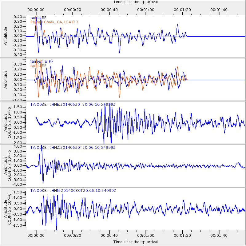
O03E Paynes Creek, CA, USA - Earthquake Result Viewer
*The percent match for this event was below the threshold and hence no stack was calculated.
| Earthquake location: |
Bonin Islands, Japan Region |
| Earthquake latitude/longitude: |
28.4/138.9 |
| Earthquake time(UTC): |
2014/06/30 (181) 19:55:32 GMT |
| Earthquake Depth: |
512 km |
| Earthquake Magnitude: |
6.2 MWB |
| Earthquake Catalog/Contributor: |
NEIC PDE/NEIC COMCAT |
|
| Network: |
TA USArray Transportable Network (new EarthScope stations) |
| Station: |
O03E Paynes Creek, CA, USA |
| Lat/Lon: |
40.29 N/121.80 W |
| Elevation: |
967 m |
|
| Distance: |
78.8 deg |
| Az: |
50.31 deg |
| Baz: |
297.537 deg |
| Ray Param: |
$rayparam |
*The percent match for this event was below the threshold and hence was not used in the summary stack. |
|
| Radial Match: |
66.880905 % |
| Radial Bump: |
376 |
| Transverse Match: |
64.49683 % |
| Transverse Bump: |
400 |
| SOD ConfigId: |
751272 |
| Insert Time: |
2014-07-14 20:46:03.091 +0000 |
| GWidth: |
2.5 |
| Max Bumps: |
400 |
| Tol: |
0.001 |
|
Signal To Noise
| Channel | StoN | STA | LTA |
| TA:O03E: :HHZ:20140630T20:06:10.54999Z | 10.996339 | 1.7099367E-6 | 1.5550053E-7 |
| TA:O03E: :HHN:20140630T20:06:10.54999Z | 3.0006855 | 4.4850427E-7 | 1.4946727E-7 |
| TA:O03E: :HHE:20140630T20:06:10.54999Z | 2.0189738 | 4.0228767E-7 | 1.9925353E-7 |
| Arrivals |
| Ps | |
| PpPs | |
| PsPs/PpSs | |


