You are here: Home > Network List > UW - Pacific Northwest Regional Seismic Network Stations List
> Station UMAT Pilot Rock, OR, USA > Earthquake Result Viewer
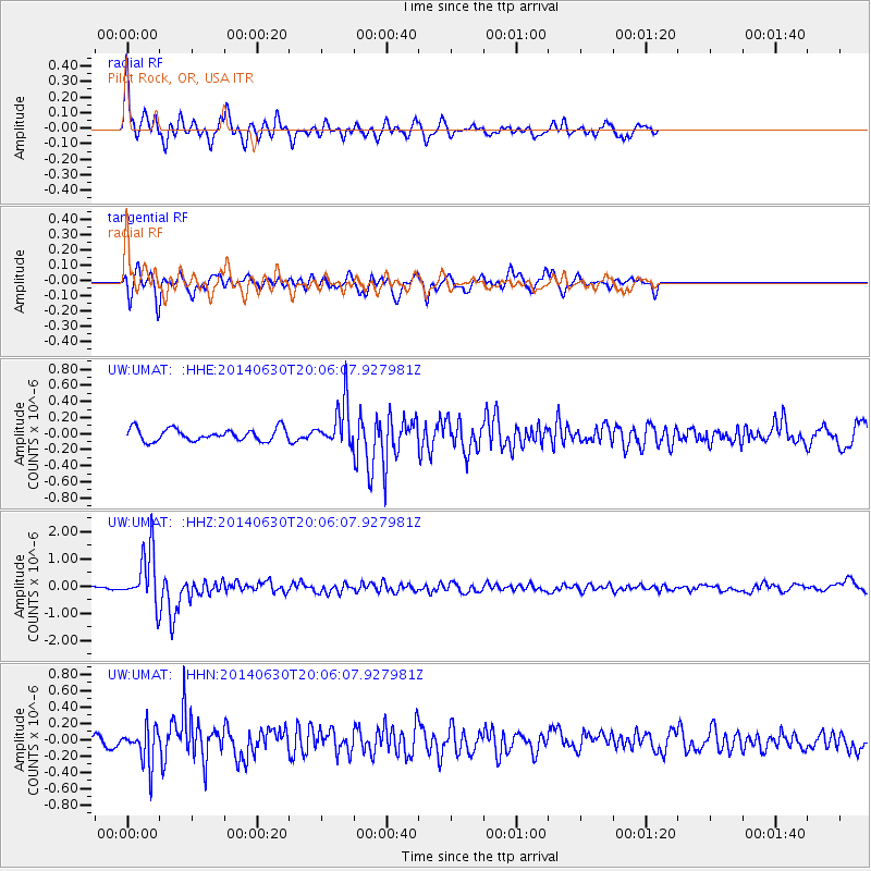
UMAT Pilot Rock, OR, USA - Earthquake Result Viewer
*The percent match for this event was below the threshold and hence no stack was calculated.
| Earthquake location: |
Bonin Islands, Japan Region |
| Earthquake latitude/longitude: |
28.4/138.9 |
| Earthquake time(UTC): |
2014/06/30 (181) 19:55:32 GMT |
| Earthquake Depth: |
512 km |
| Earthquake Magnitude: |
6.2 MWB |
| Earthquake Catalog/Contributor: |
NEIC PDE/NEIC COMCAT |
|
| Network: |
UW Pacific Northwest Regional Seismic Network |
| Station: |
UMAT Pilot Rock, OR, USA |
| Lat/Lon: |
45.29 N/118.96 W |
| Elevation: |
1318 m |
|
| Distance: |
78.3 deg |
| Az: |
44.809 deg |
| Baz: |
298.366 deg |
| Ray Param: |
$rayparam |
*The percent match for this event was below the threshold and hence was not used in the summary stack. |
|
| Radial Match: |
79.62132 % |
| Radial Bump: |
400 |
| Transverse Match: |
78.42982 % |
| Transverse Bump: |
400 |
| SOD ConfigId: |
751272 |
| Insert Time: |
2014-07-14 20:53:09.296 +0000 |
| GWidth: |
2.5 |
| Max Bumps: |
400 |
| Tol: |
0.001 |
|
Signal To Noise
| Channel | StoN | STA | LTA |
| UW:UMAT: :HHZ:20140630T20:06:07.927981Z | 15.9127035 | 9.922313E-7 | 6.2354665E-8 |
| UW:UMAT: :HHN:20140630T20:06:07.927981Z | 5.507882 | 2.3074178E-7 | 4.1893014E-8 |
| UW:UMAT: :HHE:20140630T20:06:07.927981Z | 3.65412 | 2.7732398E-7 | 7.58935E-8 |
| Arrivals |
| Ps | |
| PpPs | |
| PsPs/PpSs | |


