CGRP Cima Grappa - Earthquake Result Viewer
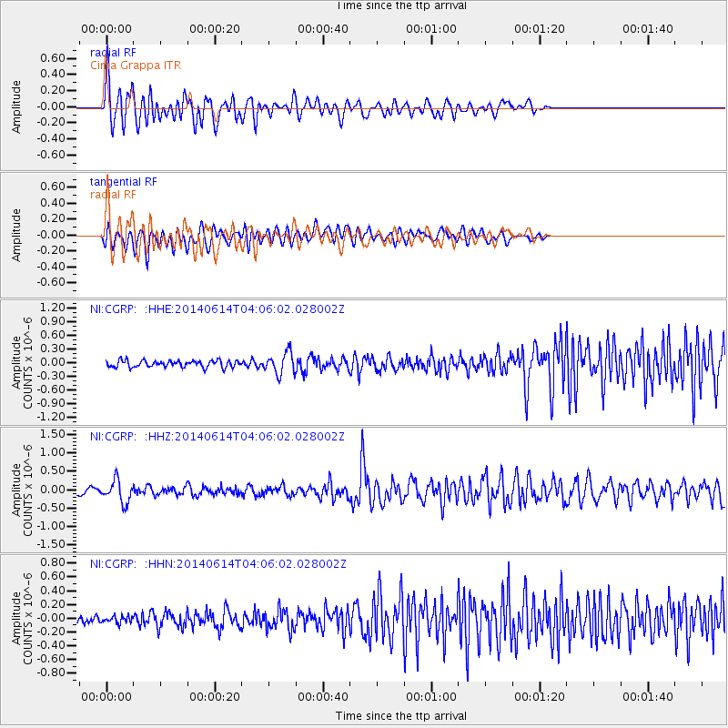
Earthquake location: Hindu Kush Region, Afghanistan
Earthquake latitude/longitude: 36.5/70.7
Earthquake time(UTC): 2014/06/14 (165) 03:58:41 GMT
Earthquake Depth: 200 km
Earthquake Magnitude: 5.6 MWW, 5.6 MWB, 5.6 MWC
Earthquake Catalog/Contributor: NEIC PDE/NEIC COMCAT
Network: NI North-East Italy Broadband Network
Station: CGRP Cima Grappa
Lat/Lon: 45.88 N/11.80 E
Elevation: 1757 m
Distance: 44.4 deg
Az: 301.284 deg
Baz: 80.51 deg
Ray Param: 0.071145475
Estimated Moho Depth: 36.25 km
Estimated Crust Vp/Vs: 1.79
Assumed Crust Vp: 6.155 km/s
Estimated Crust Vs: 3.443 km/s
Estimated Crust Poisson's Ratio: 0.27
Radial Match: 81.736 %
Radial Bump: 400
Transverse Match: 72.74824 %
Transverse Bump: 400
SOD ConfigId: 751272
Insert Time: 2014-07-17 02:35:54.174 +0000
GWidth: 2.5
Max Bumps: 400
Tol: 0.001

Signal To Noise

ChannelStoNSTALTA
NI:CGRP: :HHZ:20140614T04:06:02.028002Z5.51107363.040892E-75.5177853E-8
NI:CGRP: :HHN:20140614T04:06:02.028002Z1.12582614.931635E-84.3804587E-8
NI:CGRP: :HHE:20140614T04:06:02.028002Z3.22347382.3463504E-77.27895E-8
Arrivals
Ps4.9 SECOND
PpPs16 SECOND
PsPs/PpSs20 SECOND