You are here: Home > Network List > TA - USArray Transportable Network (new EarthScope stations) Stations List
> Station A04D Lummi Island, WA, USA > Earthquake Result Viewer
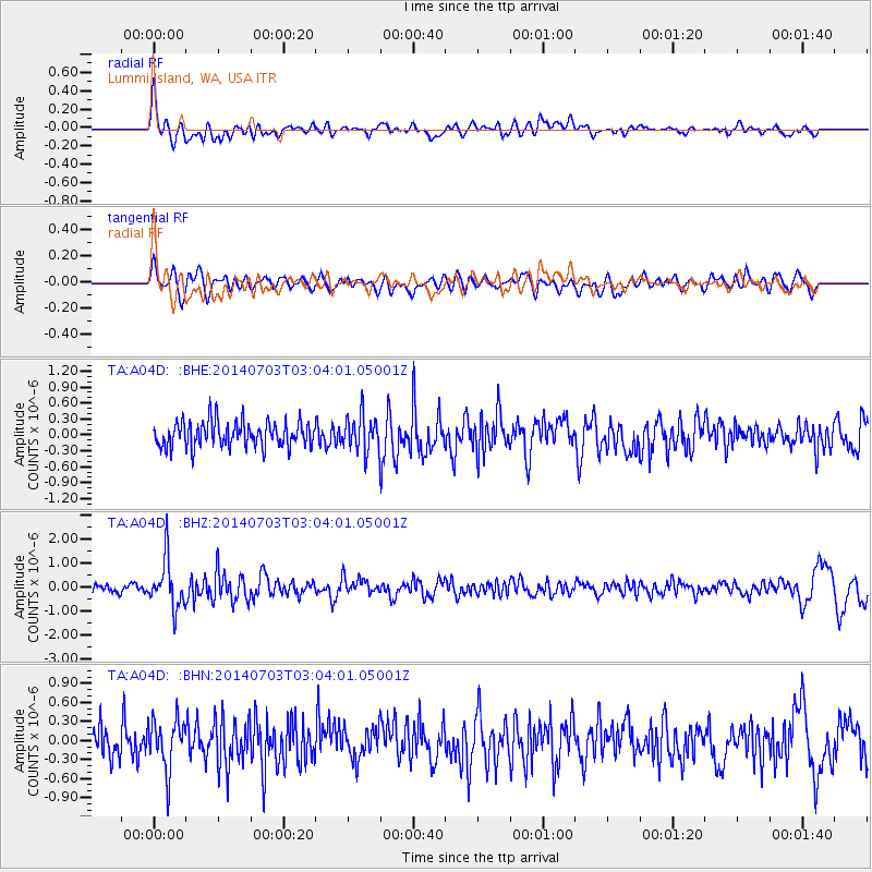
A04D Lummi Island, WA, USA - Earthquake Result Viewer
*The percent match for this event was below the threshold and hence no stack was calculated.
| Earthquake location: |
Komandorskiye Ostrova Region |
| Earthquake latitude/longitude: |
55.3/166.9 |
| Earthquake time(UTC): |
2014/07/03 (184) 02:56:41 GMT |
| Earthquake Depth: |
23 km |
| Earthquake Magnitude: |
5.8 MWP |
| Earthquake Catalog/Contributor: |
NEIC PDE/NEIC COMCAT |
|
| Network: |
TA USArray Transportable Network (new EarthScope stations) |
| Station: |
A04D Lummi Island, WA, USA |
| Lat/Lon: |
48.72 N/122.71 W |
| Elevation: |
13 m |
|
| Distance: |
42.1 deg |
| Az: |
68.443 deg |
| Baz: |
306.566 deg |
| Ray Param: |
$rayparam |
*The percent match for this event was below the threshold and hence was not used in the summary stack. |
|
| Radial Match: |
67.76648 % |
| Radial Bump: |
400 |
| Transverse Match: |
54.83278 % |
| Transverse Bump: |
400 |
| SOD ConfigId: |
751272 |
| Insert Time: |
2014-07-17 03:39:35.382 +0000 |
| GWidth: |
2.5 |
| Max Bumps: |
400 |
| Tol: |
0.001 |
|
Signal To Noise
| Channel | StoN | STA | LTA |
| TA:A04D: :BHZ:20140703T03:04:01.05001Z | 5.3157206 | 1.0019255E-6 | 1.8848348E-7 |
| TA:A04D: :BHN:20140703T03:04:01.05001Z | 1.720231 | 4.10041E-7 | 2.3836391E-7 |
| TA:A04D: :BHE:20140703T03:04:01.05001Z | 1.4210756 | 3.3488993E-7 | 2.3565948E-7 |
| Arrivals |
| Ps | |
| PpPs | |
| PsPs/PpSs | |


