You are here: Home > Network List > TA - USArray Transportable Network (new EarthScope stations) Stations List
> Station K49A Clarkson, MI, USA > Earthquake Result Viewer
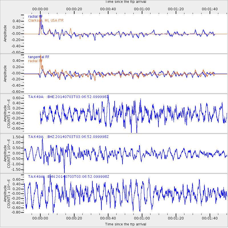
K49A Clarkson, MI, USA - Earthquake Result Viewer
*The percent match for this event was below the threshold and hence no stack was calculated.
| Earthquake location: |
Komandorskiye Ostrova Region |
| Earthquake latitude/longitude: |
55.3/166.9 |
| Earthquake time(UTC): |
2014/07/03 (184) 02:56:41 GMT |
| Earthquake Depth: |
23 km |
| Earthquake Magnitude: |
5.8 MWP |
| Earthquake Catalog/Contributor: |
NEIC PDE/NEIC COMCAT |
|
| Network: |
TA USArray Transportable Network (new EarthScope stations) |
| Station: |
K49A Clarkson, MI, USA |
| Lat/Lon: |
42.78 N/83.46 W |
| Elevation: |
336 m |
|
| Distance: |
65.6 deg |
| Az: |
49.58 deg |
| Baz: |
323.743 deg |
| Ray Param: |
$rayparam |
*The percent match for this event was below the threshold and hence was not used in the summary stack. |
|
| Radial Match: |
69.809326 % |
| Radial Bump: |
400 |
| Transverse Match: |
57.46695 % |
| Transverse Bump: |
400 |
| SOD ConfigId: |
751272 |
| Insert Time: |
2014-07-17 03:43:20.455 +0000 |
| GWidth: |
2.5 |
| Max Bumps: |
400 |
| Tol: |
0.001 |
|
Signal To Noise
| Channel | StoN | STA | LTA |
| TA:K49A: :BHZ:20140703T03:06:52.099998Z | 2.6826012 | 5.4066544E-7 | 2.0154522E-7 |
| TA:K49A: :BHN:20140703T03:06:52.099998Z | 1.607274 | 3.7748524E-7 | 2.3486054E-7 |
| TA:K49A: :BHE:20140703T03:06:52.099998Z | 1.0261291 | 1.8495992E-7 | 1.8025014E-7 |
| Arrivals |
| Ps | |
| PpPs | |
| PsPs/PpSs | |


