You are here: Home > Network List > TA - USArray Transportable Network (new EarthScope stations) Stations List
> Station T57A Hurt, VA, USA > Earthquake Result Viewer
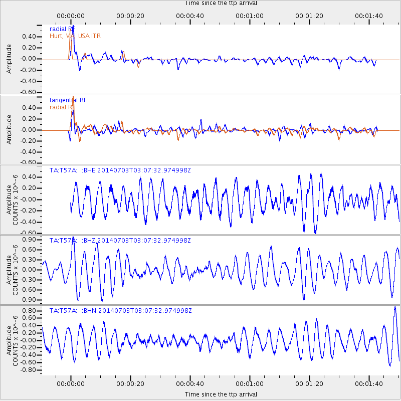
T57A Hurt, VA, USA - Earthquake Result Viewer
*The percent match for this event was below the threshold and hence no stack was calculated.
| Earthquake location: |
Komandorskiye Ostrova Region |
| Earthquake latitude/longitude: |
55.3/166.9 |
| Earthquake time(UTC): |
2014/07/03 (184) 02:56:41 GMT |
| Earthquake Depth: |
23 km |
| Earthquake Magnitude: |
5.8 MWP |
| Earthquake Catalog/Contributor: |
NEIC PDE/NEIC COMCAT |
|
| Network: |
TA USArray Transportable Network (new EarthScope stations) |
| Station: |
T57A Hurt, VA, USA |
| Lat/Lon: |
37.00 N/79.25 W |
| Elevation: |
230 m |
|
| Distance: |
72.2 deg |
| Az: |
50.265 deg |
| Baz: |
326.679 deg |
| Ray Param: |
$rayparam |
*The percent match for this event was below the threshold and hence was not used in the summary stack. |
|
| Radial Match: |
71.63765 % |
| Radial Bump: |
400 |
| Transverse Match: |
68.74889 % |
| Transverse Bump: |
400 |
| SOD ConfigId: |
751272 |
| Insert Time: |
2014-07-17 03:46:36.857 +0000 |
| GWidth: |
2.5 |
| Max Bumps: |
400 |
| Tol: |
0.001 |
|
Signal To Noise
| Channel | StoN | STA | LTA |
| TA:T57A: :BHZ:20140703T03:07:32.974998Z | 2.4690163 | 5.771106E-7 | 2.3374109E-7 |
| TA:T57A: :BHN:20140703T03:07:32.974998Z | 1.5741585 | 3.2734138E-7 | 2.079469E-7 |
| TA:T57A: :BHE:20140703T03:07:32.974998Z | 1.0428762 | 2.0524608E-7 | 1.968077E-7 |
| Arrivals |
| Ps | |
| PpPs | |
| PsPs/PpSs | |


