You are here: Home > Network List > US - United States National Seismic Network Stations List
> Station HAWA Hanford, Washington, USA > Earthquake Result Viewer
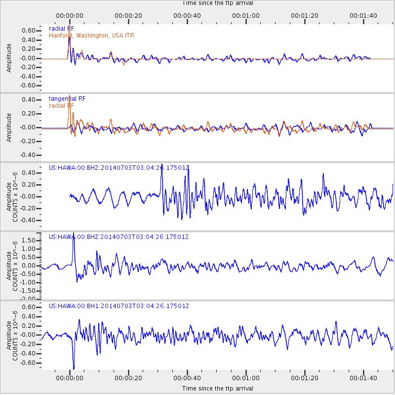
HAWA Hanford, Washington, USA - Earthquake Result Viewer
*The percent match for this event was below the threshold and hence no stack was calculated.
| Earthquake location: |
Komandorskiye Ostrova Region |
| Earthquake latitude/longitude: |
55.3/166.9 |
| Earthquake time(UTC): |
2014/07/03 (184) 02:56:41 GMT |
| Earthquake Depth: |
23 km |
| Earthquake Magnitude: |
5.8 MWP |
| Earthquake Catalog/Contributor: |
NEIC PDE/NEIC COMCAT |
|
| Network: |
US United States National Seismic Network |
| Station: |
HAWA Hanford, Washington, USA |
| Lat/Lon: |
46.39 N/119.53 W |
| Elevation: |
364 m |
|
| Distance: |
45.3 deg |
| Az: |
69.182 deg |
| Baz: |
309.437 deg |
| Ray Param: |
$rayparam |
*The percent match for this event was below the threshold and hence was not used in the summary stack. |
|
| Radial Match: |
79.8793 % |
| Radial Bump: |
400 |
| Transverse Match: |
61.234444 % |
| Transverse Bump: |
400 |
| SOD ConfigId: |
751272 |
| Insert Time: |
2014-07-17 03:49:52.031 +0000 |
| GWidth: |
2.5 |
| Max Bumps: |
400 |
| Tol: |
0.001 |
|
Signal To Noise
| Channel | StoN | STA | LTA |
| US:HAWA:00:BHZ:20140703T03:04:26.17501Z | 7.694933 | 6.99421E-7 | 9.089371E-8 |
| US:HAWA:00:BH1:20140703T03:04:26.17501Z | 3.4768298 | 2.3017574E-7 | 6.6202766E-8 |
| US:HAWA:00:BH2:20140703T03:04:26.17501Z | 2.3821762 | 1.8701249E-7 | 7.85049E-8 |
| Arrivals |
| Ps | |
| PpPs | |
| PsPs/PpSs | |


