You are here: Home > Network List > US - United States National Seismic Network Stations List
> Station MNTX Cornudas Mountains, Texas, USA > Earthquake Result Viewer
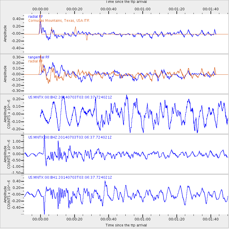
MNTX Cornudas Mountains, Texas, USA - Earthquake Result Viewer
*The percent match for this event was below the threshold and hence no stack was calculated.
| Earthquake location: |
Komandorskiye Ostrova Region |
| Earthquake latitude/longitude: |
55.3/166.9 |
| Earthquake time(UTC): |
2014/07/03 (184) 02:56:41 GMT |
| Earthquake Depth: |
23 km |
| Earthquake Magnitude: |
5.8 MWP |
| Earthquake Catalog/Contributor: |
NEIC PDE/NEIC COMCAT |
|
| Network: |
US United States National Seismic Network |
| Station: |
MNTX Cornudas Mountains, Texas, USA |
| Lat/Lon: |
31.70 N/105.38 W |
| Elevation: |
404 m |
|
| Distance: |
63.4 deg |
| Az: |
72.315 deg |
| Baz: |
320.267 deg |
| Ray Param: |
$rayparam |
*The percent match for this event was below the threshold and hence was not used in the summary stack. |
|
| Radial Match: |
70.848206 % |
| Radial Bump: |
400 |
| Transverse Match: |
67.53944 % |
| Transverse Bump: |
400 |
| SOD ConfigId: |
751272 |
| Insert Time: |
2014-07-17 03:50:43.128 +0000 |
| GWidth: |
2.5 |
| Max Bumps: |
400 |
| Tol: |
0.001 |
|
Signal To Noise
| Channel | StoN | STA | LTA |
| US:MNTX:00:BHZ:20140703T03:06:37.724021Z | 3.2207758 | 5.068135E-7 | 1.5735758E-7 |
| US:MNTX:00:BH1:20140703T03:06:37.724021Z | 1.5296171 | 1.900908E-7 | 1.2427346E-7 |
| US:MNTX:00:BH2:20140703T03:06:37.724021Z | 0.9844794 | 1.0576601E-7 | 1.0743344E-7 |
| Arrivals |
| Ps | |
| PpPs | |
| PsPs/PpSs | |


