You are here: Home > Network List > UW - Pacific Northwest Regional Seismic Network Stations List
> Station LEBA Lebam, WA, USA > Earthquake Result Viewer
LEBA Lebam, WA, USA - Earthquake Result Viewer
*The percent match for this event was below the threshold and hence no stack was calculated.
| Earthquake location: |
Off East Coast Of Honshu, Japan |
| Earthquake latitude/longitude: |
36.3/143.1 |
| Earthquake time(UTC): |
2015/03/27 (086) 03:04:05 GMT |
| Earthquake Depth: |
0.2 km |
| Earthquake Magnitude: |
5.5 MWP |
| Earthquake Catalog/Contributor: |
NEIC PDE/NEIC COMCAT |
|
| Network: |
UW Pacific Northwest Regional Seismic Network |
| Station: |
LEBA Lebam, WA, USA |
| Lat/Lon: |
46.55 N/123.56 W |
| Elevation: |
73 m |
|
| Distance: |
66.8 deg |
| Az: |
48.577 deg |
| Baz: |
298.661 deg |
| Ray Param: |
$rayparam |
*The percent match for this event was below the threshold and hence was not used in the summary stack. |
|
| Radial Match: |
54.955154 % |
| Radial Bump: |
400 |
| Transverse Match: |
68.44597 % |
| Transverse Bump: |
400 |
| SOD ConfigId: |
7422571 |
| Insert Time: |
2019-04-17 22:17:02.837 +0000 |
| GWidth: |
2.5 |
| Max Bumps: |
400 |
| Tol: |
0.001 |
|
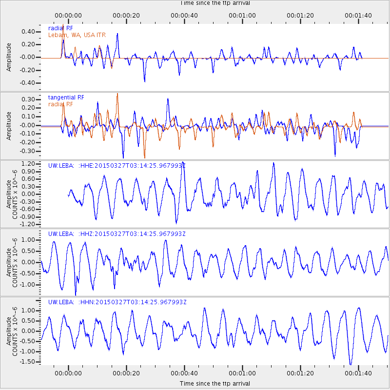
Signal To Noise
| Channel | StoN | STA | LTA |
| UW:LEBA: :HHZ:20150327T03:14:25.967993Z | 2.3319771 | 6.904452E-7 | 2.9607716E-7 |
| UW:LEBA: :HHN:20150327T03:14:25.967993Z | 1.1778581 | 4.2593626E-7 | 3.6161933E-7 |
| UW:LEBA: :HHE:20150327T03:14:25.967993Z | 1.0017034 | 4.289774E-7 | 4.2824792E-7 |
| Arrivals |
| Ps | |
| PpPs | |
| PsPs/PpSs | |


