You are here: Home > Network List > II - Global Seismograph Network (GSN - IRIS/IDA) Stations List
> Station WRAB Tennant Creek, NT, Australia > Earthquake Result Viewer
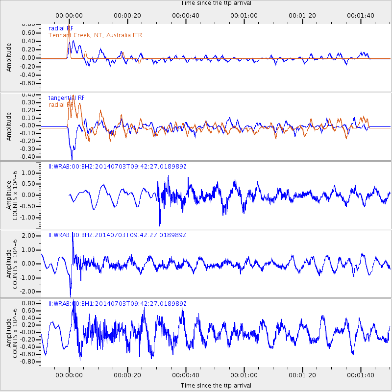
WRAB Tennant Creek, NT, Australia - Earthquake Result Viewer
*The percent match for this event was below the threshold and hence no stack was calculated.
| Earthquake location: |
South Of Fiji Islands |
| Earthquake latitude/longitude: |
-22.1/-179.4 |
| Earthquake time(UTC): |
2014/07/03 (184) 09:35:49 GMT |
| Earthquake Depth: |
599 km |
| Earthquake Magnitude: |
5.6 MB |
| Earthquake Catalog/Contributor: |
NEIC PDE/NEIC COMCAT |
|
| Network: |
II Global Seismograph Network (GSN - IRIS/IDA) |
| Station: |
WRAB Tennant Creek, NT, Australia |
| Lat/Lon: |
19.93 S/134.36 E |
| Elevation: |
366 m |
|
| Distance: |
43.1 deg |
| Az: |
264.017 deg |
| Baz: |
101.297 deg |
| Ray Param: |
$rayparam |
*The percent match for this event was below the threshold and hence was not used in the summary stack. |
|
| Radial Match: |
60.219254 % |
| Radial Bump: |
400 |
| Transverse Match: |
79.08435 % |
| Transverse Bump: |
400 |
| SOD ConfigId: |
751272 |
| Insert Time: |
2014-07-17 10:03:36.167 +0000 |
| GWidth: |
2.5 |
| Max Bumps: |
400 |
| Tol: |
0.001 |
|
Signal To Noise
| Channel | StoN | STA | LTA |
| II:WRAB:00:BHZ:20140703T09:42:27.018989Z | 2.8274963 | 8.372696E-7 | 2.9611698E-7 |
| II:WRAB:00:BH1:20140703T09:42:27.018989Z | 1.8323681 | 4.2475844E-7 | 2.3180847E-7 |
| II:WRAB:00:BH2:20140703T09:42:27.018989Z | 1.6228299 | 4.4219146E-7 | 2.724817E-7 |
| Arrivals |
| Ps | |
| PpPs | |
| PsPs/PpSs | |


