You are here: Home > Network List > TA - USArray Transportable Network (new EarthScope stations) Stations List
> Station O03E Paynes Creek, CA, USA > Earthquake Result Viewer
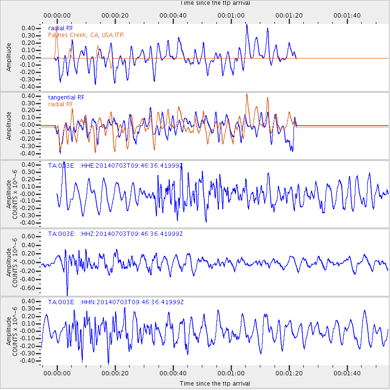
O03E Paynes Creek, CA, USA - Earthquake Result Viewer
*The percent match for this event was below the threshold and hence no stack was calculated.
| Earthquake location: |
South Of Fiji Islands |
| Earthquake latitude/longitude: |
-22.1/-179.4 |
| Earthquake time(UTC): |
2014/07/03 (184) 09:35:49 GMT |
| Earthquake Depth: |
599 km |
| Earthquake Magnitude: |
5.6 MB |
| Earthquake Catalog/Contributor: |
NEIC PDE/NEIC COMCAT |
|
| Network: |
TA USArray Transportable Network (new EarthScope stations) |
| Station: |
O03E Paynes Creek, CA, USA |
| Lat/Lon: |
40.29 N/121.80 W |
| Elevation: |
967 m |
|
| Distance: |
82.0 deg |
| Az: |
40.728 deg |
| Baz: |
232.309 deg |
| Ray Param: |
$rayparam |
*The percent match for this event was below the threshold and hence was not used in the summary stack. |
|
| Radial Match: |
58.23778 % |
| Radial Bump: |
400 |
| Transverse Match: |
53.0614 % |
| Transverse Bump: |
400 |
| SOD ConfigId: |
751272 |
| Insert Time: |
2014-07-17 10:08:47.344 +0000 |
| GWidth: |
2.5 |
| Max Bumps: |
400 |
| Tol: |
0.001 |
|
Signal To Noise
| Channel | StoN | STA | LTA |
| TA:O03E: :HHZ:20140703T09:46:36.41999Z | 2.1099725 | 2.3131773E-7 | 1.0963069E-7 |
| TA:O03E: :HHN:20140703T09:46:36.41999Z | 0.6928128 | 9.283802E-8 | 1.340016E-7 |
| TA:O03E: :HHE:20140703T09:46:36.41999Z | 0.5153634 | 8.313812E-8 | 1.6131939E-7 |
| Arrivals |
| Ps | |
| PpPs | |
| PsPs/PpSs | |


