You are here: Home > Network List > US - United States National Seismic Network Stations List
> Station HAWA Hanford, Washington, USA > Earthquake Result Viewer
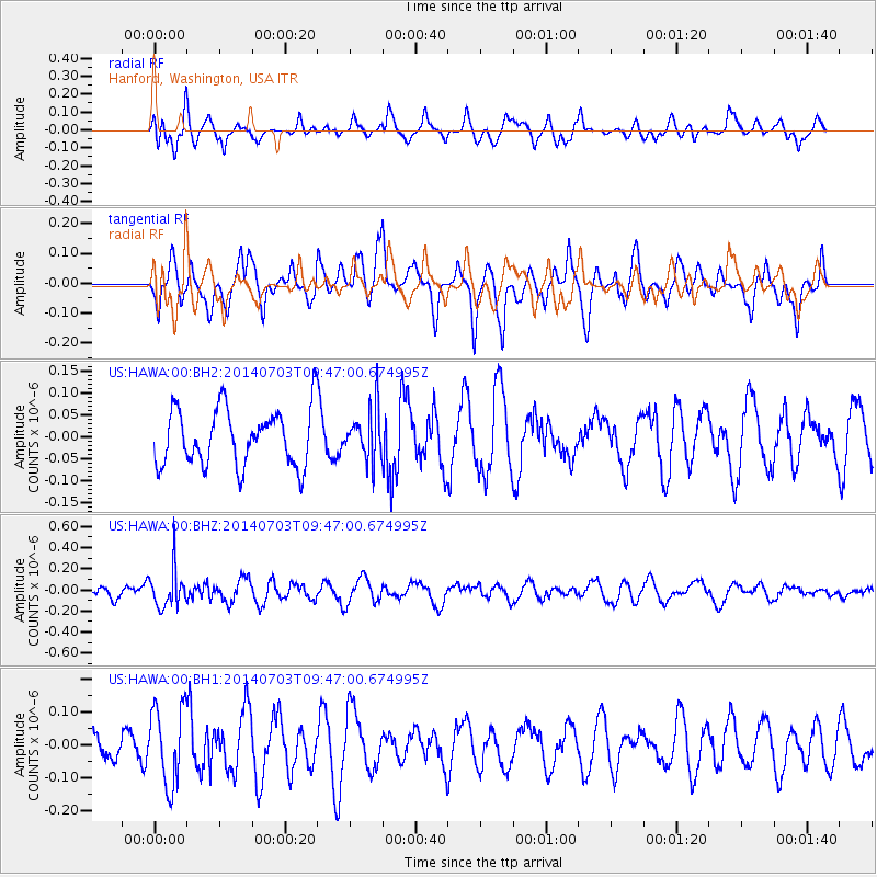
HAWA Hanford, Washington, USA - Earthquake Result Viewer
*The percent match for this event was below the threshold and hence no stack was calculated.
| Earthquake location: |
South Of Fiji Islands |
| Earthquake latitude/longitude: |
-22.1/-179.4 |
| Earthquake time(UTC): |
2014/07/03 (184) 09:35:49 GMT |
| Earthquake Depth: |
599 km |
| Earthquake Magnitude: |
5.6 MB |
| Earthquake Catalog/Contributor: |
NEIC PDE/NEIC COMCAT |
|
| Network: |
US United States National Seismic Network |
| Station: |
HAWA Hanford, Washington, USA |
| Lat/Lon: |
46.39 N/119.53 W |
| Elevation: |
364 m |
|
| Distance: |
87.0 deg |
| Az: |
36.85 deg |
| Baz: |
233.492 deg |
| Ray Param: |
$rayparam |
*The percent match for this event was below the threshold and hence was not used in the summary stack. |
|
| Radial Match: |
50.898823 % |
| Radial Bump: |
400 |
| Transverse Match: |
59.56847 % |
| Transverse Bump: |
400 |
| SOD ConfigId: |
751272 |
| Insert Time: |
2014-07-17 10:09:42.310 +0000 |
| GWidth: |
2.5 |
| Max Bumps: |
400 |
| Tol: |
0.001 |
|
Signal To Noise
| Channel | StoN | STA | LTA |
| US:HAWA:00:BHZ:20140703T09:47:00.674995Z | 2.268394 | 1.8274491E-7 | 8.0561364E-8 |
| US:HAWA:00:BH1:20140703T09:47:00.674995Z | 2.8689446 | 1.17186744E-7 | 4.0846636E-8 |
| US:HAWA:00:BH2:20140703T09:47:00.674995Z | 0.8698203 | 5.6097143E-8 | 6.4492795E-8 |
| Arrivals |
| Ps | |
| PpPs | |
| PsPs/PpSs | |


