You are here: Home > Network List > TA - USArray Transportable Network (new EarthScope stations) Stations List
> Station Z41A Richland Creek Farm, El Dorado, AR, USA > Earthquake Result Viewer
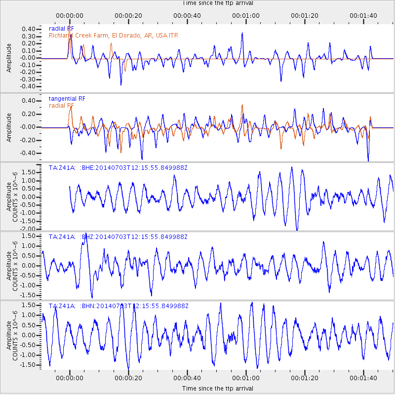
Z41A Richland Creek Farm, El Dorado, AR, USA - Earthquake Result Viewer
*The percent match for this event was below the threshold and hence no stack was calculated.
| Earthquake location: |
Komandorskiye Ostrova Region |
| Earthquake latitude/longitude: |
55.2/166.9 |
| Earthquake time(UTC): |
2014/07/03 (184) 12:05:22 GMT |
| Earthquake Depth: |
10 km |
| Earthquake Magnitude: |
5.9 MWP |
| Earthquake Catalog/Contributor: |
NEIC PDE/NEIC COMCAT |
|
| Network: |
TA USArray Transportable Network (new EarthScope stations) |
| Station: |
Z41A Richland Creek Farm, El Dorado, AR, USA |
| Lat/Lon: |
33.26 N/92.80 W |
| Elevation: |
62 m |
|
| Distance: |
68.8 deg |
| Az: |
62.163 deg |
| Baz: |
322.776 deg |
| Ray Param: |
$rayparam |
*The percent match for this event was below the threshold and hence was not used in the summary stack. |
|
| Radial Match: |
43.715755 % |
| Radial Bump: |
317 |
| Transverse Match: |
48.636963 % |
| Transverse Bump: |
330 |
| SOD ConfigId: |
751272 |
| Insert Time: |
2014-07-17 13:01:01.571 +0000 |
| GWidth: |
2.5 |
| Max Bumps: |
400 |
| Tol: |
0.001 |
|
Signal To Noise
| Channel | StoN | STA | LTA |
| TA:Z41A: :BHZ:20140703T12:15:55.849988Z | 2.4381175 | 6.602711E-7 | 2.7081185E-7 |
| TA:Z41A: :BHN:20140703T12:15:55.849988Z | 0.7161527 | 4.2823382E-7 | 5.9796434E-7 |
| TA:Z41A: :BHE:20140703T12:15:55.849988Z | 0.74999124 | 3.7638043E-7 | 5.0184644E-7 |
| Arrivals |
| Ps | |
| PpPs | |
| PsPs/PpSs | |


