You are here: Home > Network List > US - United States National Seismic Network Stations List
> Station AMTX Amarillo, Texas, USA > Earthquake Result Viewer
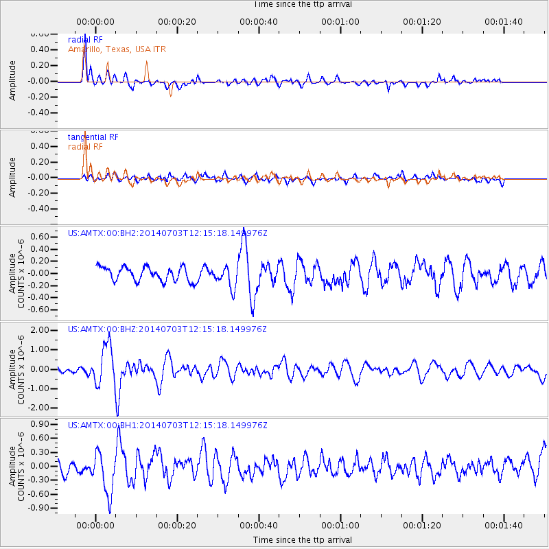
AMTX Amarillo, Texas, USA - Earthquake Result Viewer
*The percent match for this event was below the threshold and hence no stack was calculated.
| Earthquake location: |
Komandorskiye Ostrova Region |
| Earthquake latitude/longitude: |
55.2/166.9 |
| Earthquake time(UTC): |
2014/07/03 (184) 12:05:22 GMT |
| Earthquake Depth: |
10 km |
| Earthquake Magnitude: |
5.9 MWP |
| Earthquake Catalog/Contributor: |
NEIC PDE/NEIC COMCAT |
|
| Network: |
US United States National Seismic Network |
| Station: |
AMTX Amarillo, Texas, USA |
| Lat/Lon: |
34.53 N/101.41 W |
| Elevation: |
1010 m |
|
| Distance: |
63.3 deg |
| Az: |
67.42 deg |
| Baz: |
320.128 deg |
| Ray Param: |
$rayparam |
*The percent match for this event was below the threshold and hence was not used in the summary stack. |
|
| Radial Match: |
71.72497 % |
| Radial Bump: |
400 |
| Transverse Match: |
63.988316 % |
| Transverse Bump: |
400 |
| SOD ConfigId: |
751272 |
| Insert Time: |
2014-07-17 13:02:12.261 +0000 |
| GWidth: |
2.5 |
| Max Bumps: |
400 |
| Tol: |
0.001 |
|
Signal To Noise
| Channel | StoN | STA | LTA |
| US:AMTX:00:BHZ:20140703T12:15:18.149976Z | 5.4755363 | 1.0604912E-6 | 1.9367805E-7 |
| US:AMTX:00:BH1:20140703T12:15:18.149976Z | 3.24847 | 4.7449245E-7 | 1.4606644E-7 |
| US:AMTX:00:BH2:20140703T12:15:18.149976Z | 3.388271 | 3.8019945E-7 | 1.1221045E-7 |
| Arrivals |
| Ps | |
| PpPs | |
| PsPs/PpSs | |


