You are here: Home > Network List > UW - Pacific Northwest Regional Seismic Network Stations List
> Station UMAT Pilot Rock, OR, USA > Earthquake Result Viewer
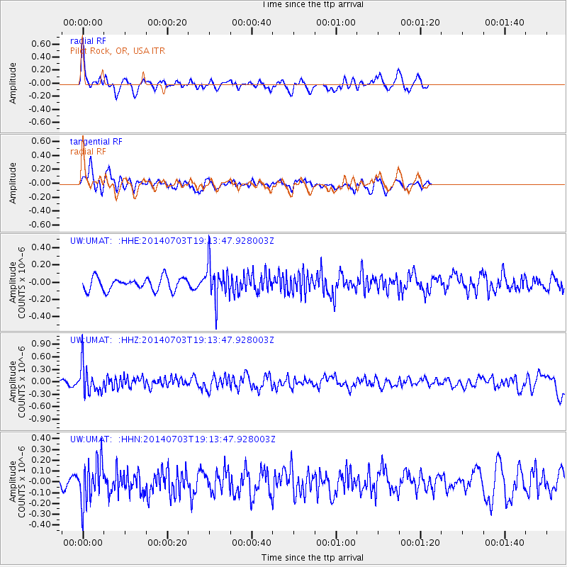
UMAT Pilot Rock, OR, USA - Earthquake Result Viewer
*The percent match for this event was below the threshold and hence no stack was calculated.
| Earthquake location: |
Rat Islands, Aleutian Islands |
| Earthquake latitude/longitude: |
52.1/178.5 |
| Earthquake time(UTC): |
2014/07/03 (184) 19:06:47 GMT |
| Earthquake Depth: |
104 km |
| Earthquake Magnitude: |
5.7 MWB, 5.6 MI |
| Earthquake Catalog/Contributor: |
NEIC PDE/NEIC COMCAT |
|
| Network: |
UW Pacific Northwest Regional Seismic Network |
| Station: |
UMAT Pilot Rock, OR, USA |
| Lat/Lon: |
45.29 N/118.96 W |
| Elevation: |
1318 m |
|
| Distance: |
40.7 deg |
| Az: |
73.849 deg |
| Baz: |
302.869 deg |
| Ray Param: |
$rayparam |
*The percent match for this event was below the threshold and hence was not used in the summary stack. |
|
| Radial Match: |
70.34321 % |
| Radial Bump: |
400 |
| Transverse Match: |
61.62407 % |
| Transverse Bump: |
400 |
| SOD ConfigId: |
751272 |
| Insert Time: |
2014-07-17 20:09:53.621 +0000 |
| GWidth: |
2.5 |
| Max Bumps: |
400 |
| Tol: |
0.001 |
|
Signal To Noise
| Channel | StoN | STA | LTA |
| UW:UMAT: :HHZ:20140703T19:13:47.928003Z | 5.0512023 | 3.4603093E-7 | 6.850466E-8 |
| UW:UMAT: :HHN:20140703T19:13:47.928003Z | 3.2497232 | 1.964002E-7 | 6.043597E-8 |
| UW:UMAT: :HHE:20140703T19:13:47.928003Z | 2.8129697 | 2.0875859E-7 | 7.4212885E-8 |
| Arrivals |
| Ps | |
| PpPs | |
| PsPs/PpSs | |


