You are here: Home > Network List > TA - USArray Transportable Network (new EarthScope stations) Stations List
> Station G59A Clarenceville, QC, USA > Earthquake Result Viewer
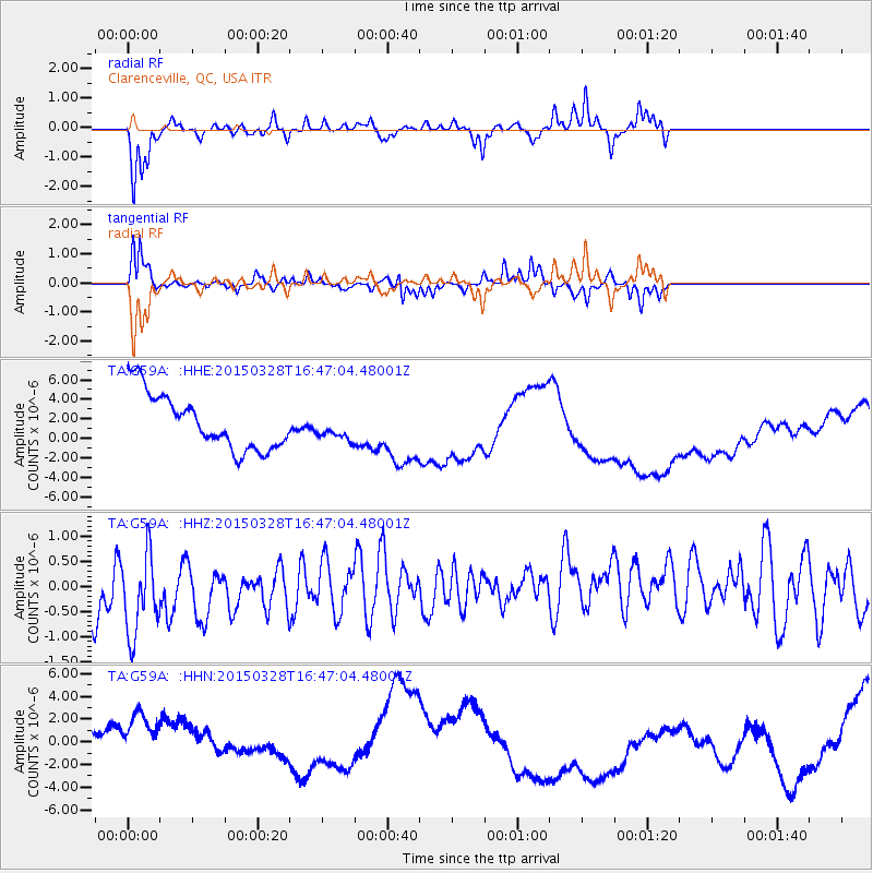
G59A Clarenceville, QC, USA - Earthquake Result Viewer
*The percent match for this event was below the threshold and hence no stack was calculated.
| Earthquake location: |
Northern Chile |
| Earthquake latitude/longitude: |
-22.2/-68.7 |
| Earthquake time(UTC): |
2015/03/28 (087) 16:36:52 GMT |
| Earthquake Depth: |
109 km |
| Earthquake Magnitude: |
6.0 MB |
| Earthquake Catalog/Contributor: |
NEIC PDE/NEIC COMCAT |
|
| Network: |
TA USArray Transportable Network (new EarthScope stations) |
| Station: |
G59A Clarenceville, QC, USA |
| Lat/Lon: |
45.08 N/73.18 W |
| Elevation: |
36 m |
|
| Distance: |
67.1 deg |
| Az: |
356.522 deg |
| Baz: |
175.449 deg |
| Ray Param: |
$rayparam |
*The percent match for this event was below the threshold and hence was not used in the summary stack. |
|
| Radial Match: |
56.867165 % |
| Radial Bump: |
291 |
| Transverse Match: |
45.445267 % |
| Transverse Bump: |
226 |
| SOD ConfigId: |
7422571 |
| Insert Time: |
2019-04-17 22:42:51.217 +0000 |
| GWidth: |
2.5 |
| Max Bumps: |
400 |
| Tol: |
0.001 |
|
Signal To Noise
| Channel | StoN | STA | LTA |
| TA:G59A: :HHZ:20150328T16:47:04.48001Z | 1.0976138 | 1.1962103E-6 | 1.0898281E-6 |
| TA:G59A: :HHN:20150328T16:47:04.48001Z | 1.237416 | 4.582026E-6 | 3.7028985E-6 |
| TA:G59A: :HHE:20150328T16:47:04.48001Z | 0.38033146 | 1.0908161E-6 | 2.8680672E-6 |
| Arrivals |
| Ps | |
| PpPs | |
| PsPs/PpSs | |


