You are here: Home > Network List > TA - USArray Transportable Network (new EarthScope stations) Stations List
> Station R11A Troy Canyon, Currant, NV, USA > Earthquake Result Viewer
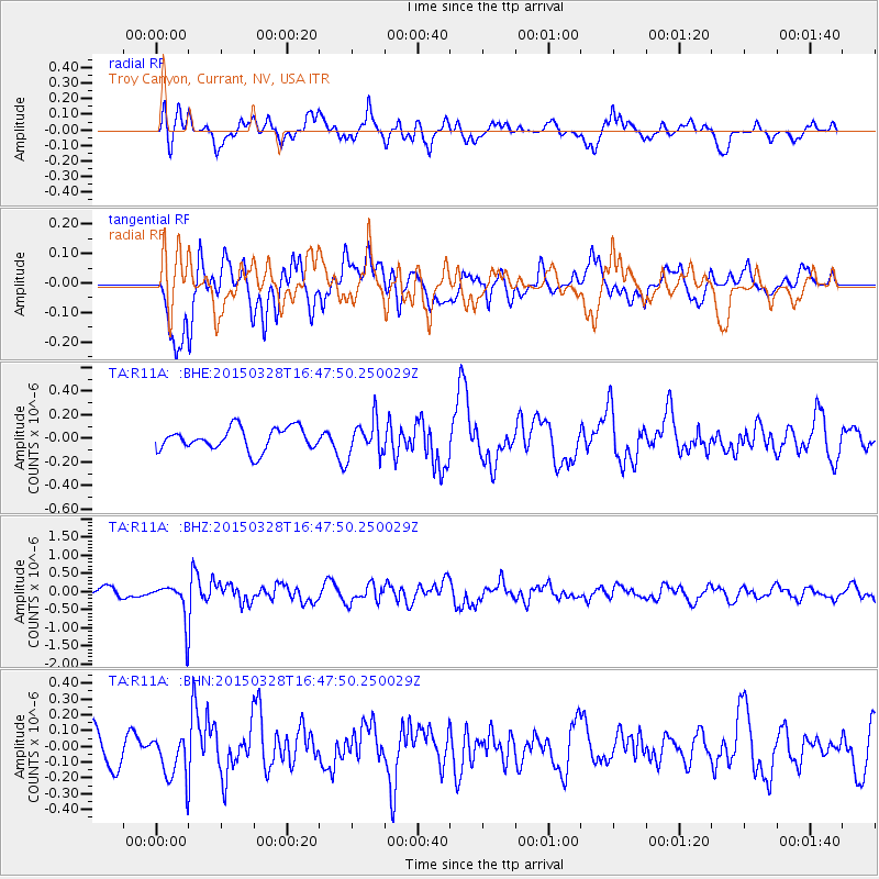
R11A Troy Canyon, Currant, NV, USA - Earthquake Result Viewer
*The percent match for this event was below the threshold and hence no stack was calculated.
| Earthquake location: |
Northern Chile |
| Earthquake latitude/longitude: |
-22.2/-68.7 |
| Earthquake time(UTC): |
2015/03/28 (087) 16:36:52 GMT |
| Earthquake Depth: |
109 km |
| Earthquake Magnitude: |
6.0 MB |
| Earthquake Catalog/Contributor: |
NEIC PDE/NEIC COMCAT |
|
| Network: |
TA USArray Transportable Network (new EarthScope stations) |
| Station: |
R11A Troy Canyon, Currant, NV, USA |
| Lat/Lon: |
38.35 N/115.59 W |
| Elevation: |
1756 m |
|
| Distance: |
74.6 deg |
| Az: |
323.434 deg |
| Baz: |
135.398 deg |
| Ray Param: |
$rayparam |
*The percent match for this event was below the threshold and hence was not used in the summary stack. |
|
| Radial Match: |
63.861103 % |
| Radial Bump: |
400 |
| Transverse Match: |
71.59449 % |
| Transverse Bump: |
400 |
| SOD ConfigId: |
7422571 |
| Insert Time: |
2019-04-17 22:43:29.073 +0000 |
| GWidth: |
2.5 |
| Max Bumps: |
400 |
| Tol: |
0.001 |
|
Signal To Noise
| Channel | StoN | STA | LTA |
| TA:R11A: :BHZ:20150328T16:47:50.250029Z | 2.7529485 | 4.854066E-7 | 1.7632244E-7 |
| TA:R11A: :BHN:20150328T16:47:50.250029Z | 1.4283775 | 1.3752044E-7 | 9.627738E-8 |
| TA:R11A: :BHE:20150328T16:47:50.250029Z | 1.7029986 | 1.620722E-7 | 9.5168716E-8 |
| Arrivals |
| Ps | |
| PpPs | |
| PsPs/PpSs | |


