You are here: Home > Network List > G - GEOSCOPE Stations List
> Station INU Inuyama, Japan > Earthquake Result Viewer
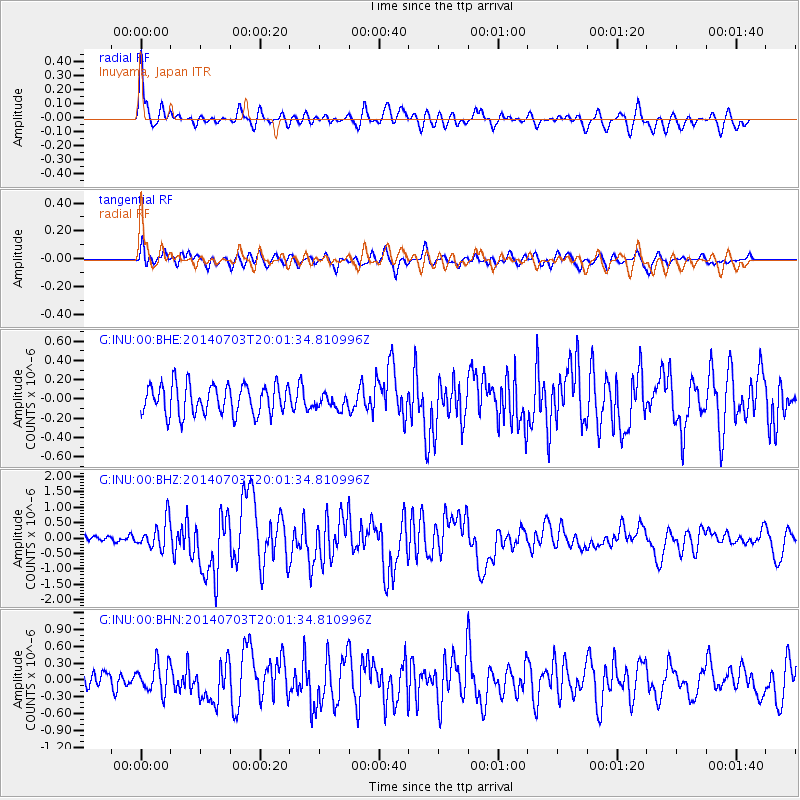
INU Inuyama, Japan - Earthquake Result Viewer
*The percent match for this event was below the threshold and hence no stack was calculated.
| Earthquake location: |
Kermadec Islands Region |
| Earthquake latitude/longitude: |
-30.5/-176.5 |
| Earthquake time(UTC): |
2014/07/03 (184) 19:50:05 GMT |
| Earthquake Depth: |
20 km |
| Earthquake Magnitude: |
6.3 MWB, 6.6 MI |
| Earthquake Catalog/Contributor: |
NEIC PDE/NEIC COMCAT |
|
| Network: |
G GEOSCOPE |
| Station: |
INU Inuyama, Japan |
| Lat/Lon: |
35.35 N/137.03 E |
| Elevation: |
132 m |
|
| Distance: |
78.8 deg |
| Az: |
322.843 deg |
| Baz: |
140.393 deg |
| Ray Param: |
$rayparam |
*The percent match for this event was below the threshold and hence was not used in the summary stack. |
|
| Radial Match: |
79.86446 % |
| Radial Bump: |
400 |
| Transverse Match: |
69.42656 % |
| Transverse Bump: |
400 |
| SOD ConfigId: |
751272 |
| Insert Time: |
2014-07-17 20:29:11.477 +0000 |
| GWidth: |
2.5 |
| Max Bumps: |
400 |
| Tol: |
0.001 |
|
Signal To Noise
| Channel | StoN | STA | LTA |
| G:INU:00:BHZ:20140703T20:01:34.810996Z | 3.4462082 | 4.663783E-7 | 1.3533086E-7 |
| G:INU:00:BHN:20140703T20:01:34.810996Z | 1.6391621 | 2.6012142E-7 | 1.586917E-7 |
| G:INU:00:BHE:20140703T20:01:34.810996Z | 0.47774518 | 7.323983E-8 | 1.5330313E-7 |
| Arrivals |
| Ps | |
| PpPs | |
| PsPs/PpSs | |


