You are here: Home > Network List > US - United States National Seismic Network Stations List
> Station AMTX Amarillo, Texas, USA > Earthquake Result Viewer
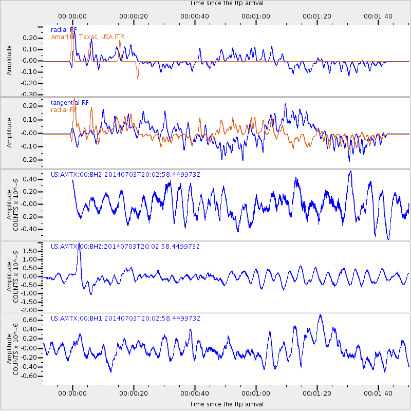
AMTX Amarillo, Texas, USA - Earthquake Result Viewer
*The percent match for this event was below the threshold and hence no stack was calculated.
| Earthquake location: |
Kermadec Islands Region |
| Earthquake latitude/longitude: |
-30.5/-176.5 |
| Earthquake time(UTC): |
2014/07/03 (184) 19:50:05 GMT |
| Earthquake Depth: |
20 km |
| Earthquake Magnitude: |
6.3 MWB, 6.6 MI |
| Earthquake Catalog/Contributor: |
NEIC PDE/NEIC COMCAT |
|
| Network: |
US United States National Seismic Network |
| Station: |
AMTX Amarillo, Texas, USA |
| Lat/Lon: |
34.53 N/101.41 W |
| Elevation: |
1010 m |
|
| Distance: |
95.9 deg |
| Az: |
53.332 deg |
| Baz: |
236.959 deg |
| Ray Param: |
$rayparam |
*The percent match for this event was below the threshold and hence was not used in the summary stack. |
|
| Radial Match: |
49.048847 % |
| Radial Bump: |
400 |
| Transverse Match: |
62.69279 % |
| Transverse Bump: |
400 |
| SOD ConfigId: |
751272 |
| Insert Time: |
2014-07-17 20:45:31.170 +0000 |
| GWidth: |
2.5 |
| Max Bumps: |
400 |
| Tol: |
0.001 |
|
Signal To Noise
| Channel | StoN | STA | LTA |
| US:AMTX:00:BHZ:20140703T20:02:58.449973Z | 7.274933 | 8.2103304E-7 | 1.1285782E-7 |
| US:AMTX:00:BH1:20140703T20:02:58.449973Z | 1.1353371 | 1.49795E-7 | 1.3193878E-7 |
| US:AMTX:00:BH2:20140703T20:02:58.449973Z | 1.6813128 | 2.265251E-7 | 1.3473108E-7 |
| Arrivals |
| Ps | |
| PpPs | |
| PsPs/PpSs | |


