You are here: Home > Network List > US - United States National Seismic Network Stations List
> Station MNTX Cornudas Mountains, Texas, USA > Earthquake Result Viewer
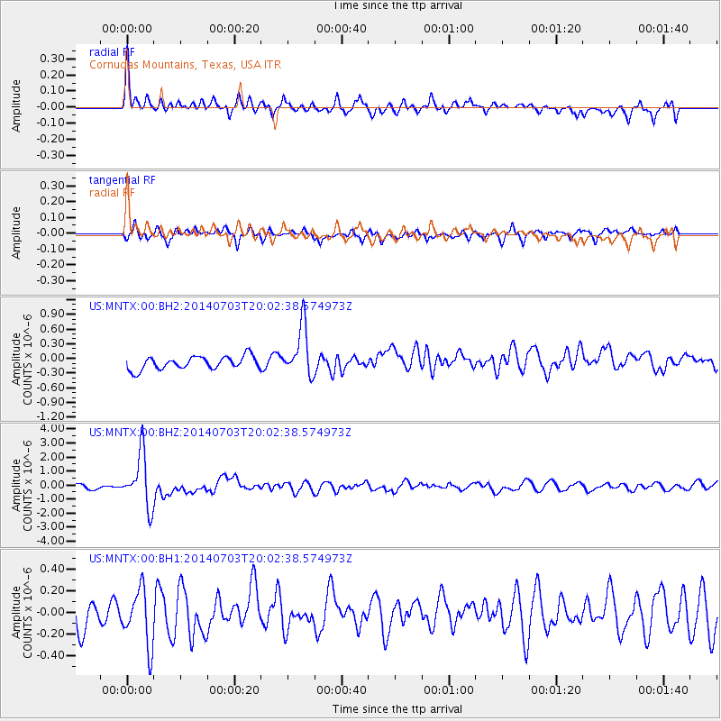
MNTX Cornudas Mountains, Texas, USA - Earthquake Result Viewer
*The percent match for this event was below the threshold and hence no stack was calculated.
| Earthquake location: |
Kermadec Islands Region |
| Earthquake latitude/longitude: |
-30.5/-176.5 |
| Earthquake time(UTC): |
2014/07/03 (184) 19:50:05 GMT |
| Earthquake Depth: |
20 km |
| Earthquake Magnitude: |
6.3 MWB, 6.6 MI |
| Earthquake Catalog/Contributor: |
NEIC PDE/NEIC COMCAT |
|
| Network: |
US United States National Seismic Network |
| Station: |
MNTX Cornudas Mountains, Texas, USA |
| Lat/Lon: |
31.70 N/105.38 W |
| Elevation: |
404 m |
|
| Distance: |
91.5 deg |
| Az: |
53.798 deg |
| Baz: |
234.767 deg |
| Ray Param: |
$rayparam |
*The percent match for this event was below the threshold and hence was not used in the summary stack. |
|
| Radial Match: |
77.00066 % |
| Radial Bump: |
400 |
| Transverse Match: |
61.538723 % |
| Transverse Bump: |
400 |
| SOD ConfigId: |
751272 |
| Insert Time: |
2014-07-17 20:46:28.236 +0000 |
| GWidth: |
2.5 |
| Max Bumps: |
400 |
| Tol: |
0.001 |
|
Signal To Noise
| Channel | StoN | STA | LTA |
| US:MNTX:00:BHZ:20140703T20:02:38.574973Z | 12.69387 | 1.924704E-6 | 1.516247E-7 |
| US:MNTX:00:BH1:20140703T20:02:38.574973Z | 1.8392861 | 2.6469903E-7 | 1.4391401E-7 |
| US:MNTX:00:BH2:20140703T20:02:38.574973Z | 3.9827504 | 5.257849E-7 | 1.3201553E-7 |
| Arrivals |
| Ps | |
| PpPs | |
| PsPs/PpSs | |


